Tres Palos geodata
Tres Palos (Guerrero) is a populated place; located in Mexico in America/Mexico_City (GMT-6) time zone. With population of 5,001 people, there are 1848 cities with bigger population in this country. Compared to other cities in Mexico, 91.3% of cities are located further ↑North; 61.2% of cities are located further →East and 95.1% of cities have higher elevation than Tres Palos. Note1


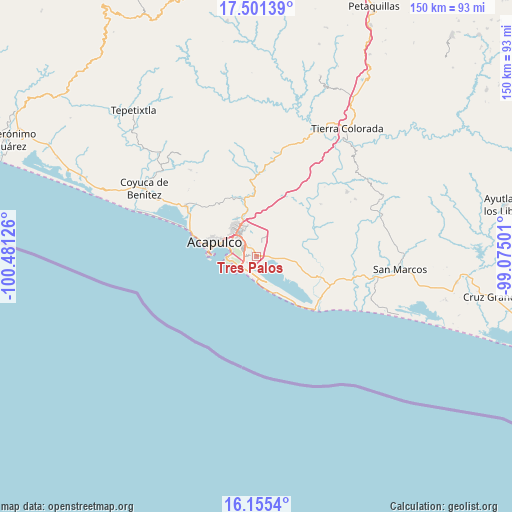
Tres Palos GPS coordinates[2]
16° 49' 46.524" North, 99° 46' 41.268" West
| Map corner | latitude | longitude |
|---|---|---|
| Upper-left | 17.50139°, | -100.48126° |
| Center: | 16.82959°, | -99.77813° |
| Lower-right: | 16.1554°, | -99.07501° |
| Map W x H: | 149.7×149.7 km | = 93×93mi |
| max Lat: | 32.7° ⇑91.3% North |
| Tres Palos: | 16.82959° |
| min Lat: | ⇓8.7% South 14.53588° |
| min Long | Tres Palos | max Long |
| -117.105° | -99.77813° | -86.73105° |
| W 38.8%⇐ | ⇒61.2% E |
Elevation
Elevation of Tres Palos is 13 m = 43 ft, and this is 1240.7 m = 4071 ft below average elevation for this country.
| Max E: |
3497 m = 11473 ft | 95.1% |
| Avg. | 1253.7 m = 4113 ft | |
| Tres Palos | 13 m = 43 ft | |
Min E: |
-1 m = -3 ft | 4.9% |
See also: Mexico elevation on elevation.city.
Geographical zone
Tres Palos is located in North Torrid zone (between Equator and Tropic of Cancer). Distance of this Northern Tropic circle is 734.6 km =456.5 mi to North.| Distance of | km | miles | from Tres Palos |
|---|---|---|---|
| North Pole | 8135.8 | 5055.4 | to North |
| Arctic Circle | 5529.9 | 3436.1 | to North |
| Tropic Cancer | 734.6 | 456.5 | to North |
| Equator | 1871.3 | 1162.8 | to South |


Nearby cities:
15 places around Tres Palos: (largest is in red/bold)
• 10 de Abril
4 km =2.5 mi,  90°
90°
• Colonia Alborada
7.2 km =4.5 mi,  323°
323°
• Colonia Miguel Terrazas Rivera
7.3 km =4.5 mi,  330°
330°
• Colonia Nueva Revolución
8.2 km =5.1 mi,  338°
338°
• El Arenal
8.1 km =5 mi,  119°
119°
• El Bejuco
7.6 km =4.7 mi, 93°
• El Metlapil
3.4 km =2.1 mi,  66°
66°
• El Salto
4.1 km =2.5 mi,  19°
19°
• Las Plazuelas
5 km =3.1 mi,  350°
350°
• Nicolás Bravo (Zanja del Teniente)
3.3 km =2.1 mi,  84°
84°
• Nueva Frontera
7.6 km =4.7 mi, 328°
• San Isidro Gallinero (El Gallinero)
8.9 km =5.5 mi,  49°
49°
• San Pedro Cacahuatepec
11.8 km =7.3 mi,  97°
97°
• San Pedro las Playas
5 km =3.1 mi, 98°
• Tuncingo
2.6 km =1.6 mi, 333°
Sources, notices
• [Note1] Compared only with cities in Mexico existing in our database
• [Src1] Map data: © OpenStreetMap contributors (CC-BY-SA)
• [Src2] Other city data from geonames.org with taken over terms of usage.
• [Src3] Geographical zone / Annual Mean Temperature by Robert A. Rohde @ Wikipedia
