San Pedro las Playas geodata
San Pedro las Playas (Guerrero) is a populated place; located in Mexico in America/Mexico_City (GMT-6) time zone. With population of 4,292 people, there are 2138 cities with bigger population in this country. Compared to other cities in Mexico, 91.4% of cities are located further ↑North; 60.6% of cities are located further →East and 97% of cities have higher elevation than San Pedro las Playas. Note1


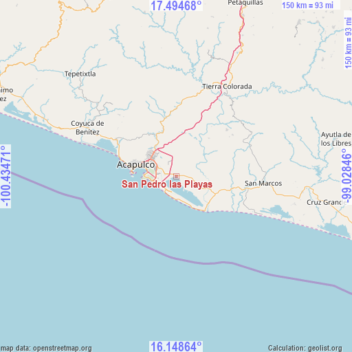
San Pedro las Playas GPS coordinates[2]
16° 49' 22.296" North, 99° 43' 53.688" West
| Map corner | latitude | longitude |
|---|---|---|
| Upper-left | 17.49468°, | -100.43471° |
| Center: | 16.82286°, | -99.73158° |
| Lower-right: | 16.14864°, | -99.02846° |
| Map W x H: | 149.7×149.7 km | = 93×93mi |
| max Lat: | 32.7° ⇑91.4% North |
| San Pedro las Playas: | 16.82286° |
| min Lat: | ⇓8.6% South 14.53588° |
| min Long | San Pedro las P | max Long |
| -117.105° | -99.73158° | -86.73105° |
| W 39.4%⇐ | ⇒60.6% E |
Elevation
Elevation of San Pedro las Playas is 10 m = 33 ft, and this is 1243.7 m = 4080 ft below average elevation for this country.
| Max E: |
3497 m = 11473 ft | 97% |
| Avg. | 1253.7 m = 4113 ft | |
| San Pedro las Playas | 10 m = 33 ft | |
Min E: |
-1 m = -3 ft | 3% |
See also: Mexico elevation on elevation.city.
Geographical zone
San Pedro las Playas is located in North Torrid zone (between Equator and Tropic of Cancer). Distance of this Northern Tropic circle is 735.4 km =457 mi to North.| Distance of | km | miles | from San Pedro las Playas |
|---|---|---|---|
| North Pole | 8136.5 | 5055.8 | to North |
| Arctic Circle | 5530.6 | 3436.6 | to North |
| Tropic Cancer | 735.4 | 457 | to North |
| Equator | 1870.5 | 1162.3 | to South |


Nearby cities:
15 places around San Pedro las Playas: (largest is in red/bold)
• 10 de Abril
1.2 km =0.7 mi,  305°
305°
• Amatillo
7 km =4.3 mi,  92°
92°
• El Arenal
3.9 km =2.4 mi,  147°
147°
• El Bejuco
2.6 km =1.6 mi, 85°
• El Metlapil
2.8 km =1.7 mi,  318°
318°
• El Salto
5.9 km =3.7 mi, 322°
• La Estación
9.2 km =5.7 mi,  131°
131°
• Las Plazuelas
8.1 km =5 mi, 314°
• Nicolás Bravo (Zanja del Teniente)
2 km =1.2 mi,  302°
302°
• Oaxaquillas
7.9 km =4.9 mi, 89°
• San Antonio
8.3 km =5.2 mi,  106°
106°
• San Isidro Gallinero (El Gallinero)
6.8 km =4.2 mi,  15°
15°
• San Pedro Cacahuatepec
6.8 km =4.2 mi,  97°
97°
• Tres Palos
5 km =3.1 mi,  278°
278°
• Tuncingo
6.9 km =4.3 mi, 296°
Sources, notices
• [Note1] Compared only with cities in Mexico existing in our database
• [Src1] Map data: © OpenStreetMap contributors (CC-BY-SA)
• [Src2] Other city data from geonames.org with taken over terms of usage.
• [Src3] Geographical zone / Annual Mean Temperature by Robert A. Rohde @ Wikipedia
