Tenamazapa geodata
Tenamazapa (Guerrero) is a populated place; located in Mexico in America/Mexico_City (GMT-6) time zone. With population of 840 people, there are 10414 cities with bigger population in this country. Compared to other cities in Mexico, 86.4% of cities are located further ↑North; 53.2% of cities are located further ←West and 50.6% of cities have higher elevation than Tenamazapa. Note1


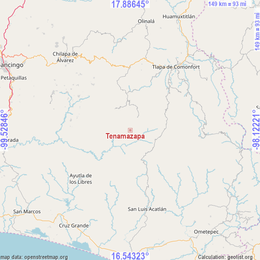
Tenamazapa GPS coordinates[2]
17° 12' 57.816" North, 98° 49' 31.188" West
| Map corner | latitude | longitude |
|---|---|---|
| Upper-left | 17.88645°, | -99.52846° |
| Center: | 17.21606°, | -98.82533° |
| Lower-right: | 16.54323°, | -98.12221° |
| Map W x H: | 149.4×149.4 km | = 92.8×92.8mi |
| max Lat: | 32.7° ⇑86.4% North |
| Tenamazapa: | 17.21606° |
| min Lat: | ⇓13.6% South 14.53588° |
| min Long | Tenamazapa | max Long |
| -117.105° | -98.82533° | -86.73105° |
| W 53.2%⇐ | ⇒46.8% E |
Elevation
Elevation of Tenamazapa is 1399 m = 4590 ft, and this is 145.3 m = 477 ft above average elevation for this country.
| Max E: |
3497 m = 11473 ft | 50.6% |
| Tenamazapa | 1399 m 4590 ft | |
| Avg. | 1253.7 m = 4113 ft | |
Min E: |
-1 m = -3 ft | 49.4% |
See also: Mexico elevation on elevation.city.
Geographical zone
Tenamazapa is located in North Torrid zone (between Equator and Tropic of Cancer). Distance of this Northern Tropic circle is 691.7 km =429.8 mi to North.| Distance of | km | miles | from Tenamazapa |
|---|---|---|---|
| North Pole | 8092.8 | 5028.6 | to North |
| Arctic Circle | 5486.9 | 3409.4 | to North |
| Tropic Cancer | 691.7 | 429.8 | to North |
| Equator | 1914.2 | 1189.4 | to South |


Nearby cities:
15 places around Tenamazapa: (largest is in red/bold)
• Apetzuca
8.7 km =5.4 mi,  355°
355°
• Barranca Pobre
7.1 km =4.4 mi,  301°
301°
• Cuixinipa
13.3 km =8.3 mi,  292°
292°
• El Capulín
9 km =5.6 mi,  18°
18°
• El Mirador
5.4 km =3.4 mi,  280°
280°
• El Tejocote
6.6 km =4.1 mi, 17°
• Llano Grande
8.7 km =5.4 mi,  225°
225°
• Mexcaltepec
14.3 km =8.9 mi,  206°
206°
• Paraje Montero (Paraje Montero de Zaragoza)
14.2 km =8.8 mi,  114°
114°
• Tapayoltepec
13.4 km =8.3 mi,  104°
104°
• Tlacoapa
9.7 km =6 mi,  57°
57°
• Totomixtlahuaca
6.9 km =4.3 mi,  159°
159°
• Yerba Santa
6.5 km =4 mi,  254°
254°
• Zilacayota
9.7 km =6 mi,  11°
11°
• Zontecomapa
11.8 km =7.3 mi,  349°
349°
Sources, notices
• [Note1] Compared only with cities in Mexico existing in our database
• [Src1] Map data: © OpenStreetMap contributors (CC-BY-SA)
• [Src2] Other city data from geonames.org with taken over terms of usage.
• [Src3] Geographical zone / Annual Mean Temperature by Robert A. Rohde @ Wikipedia
