Arroyo Prieto geodata
Arroyo Prieto (Guerrero) is a populated place; located in Mexico in America/Mexico_City (GMT-6) time zone. With population of 644 people, there are 13427 cities with bigger population in this country. Compared to other cities in Mexico, 87.9% of cities are located further ↑North; 59.7% of cities are located further ←West and 54.1% of cities have higher elevation than Arroyo Prieto. Note1


Arroyo Prieto GPS coordinates[2]
17° 4' 22.044" North, 98° 18' 41.976" West
| Map corner | latitude | longitude |
|---|---|---|
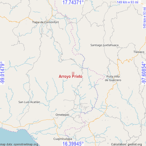
| Upper-left | 17.74371°, | -99.01479° |
| Center: | 17.07279°, | -98.31166° |
| Lower-right: | 16.39945°, | -97.60854° |
| Map W x H: | 149.5×149.5 km | = 92.9×92.9mi |
| max Lat: | 32.7° ⇑87.9% North |
| Arroyo Prieto: | 17.07279° |
| min Lat: | ⇓12.1% South 14.53588° |
| min Long | Arroyo Prieto | max Long |
| -117.105° | -98.31166° | -86.73105° |
| W 59.7%⇐ | ⇒40.3% E |
Elevation
Elevation of Arroyo Prieto is 1236 m = 4055 ft, and this is 17.7 m = 58 ft below average elevation for this country.
| Max E: |
3497 m = 11473 ft | 54.1% |
| Avg. | 1253.7 m = 4113 ft | |
| Arroyo Prieto | 1236 m = 4055 ft | |
Min E: |
-1 m = -3 ft | 45.9% |
See also: Mexico elevation on elevation.city.
Geographical zone
Arroyo Prieto is located in North Torrid zone (between Equator and Tropic of Cancer). Distance of this Northern Tropic circle is 707.6 km =439.7 mi to North.| Distance of | km | miles | from Arroyo Prieto |
|---|---|---|---|
| North Pole | 8108.7 | 5038.5 | to North |
| Arctic Circle | 5502.9 | 3419.3 | to North |
| Tropic Cancer | 707.6 | 439.7 | to North |
| Equator | 1898.3 | 1179.5 | to South |


Nearby cities:
15 places around Arroyo Prieto: (largest is in red/bold)
• Coyul
17 km =10.6 mi,  46°
46°
• El Carmen
15.7 km =9.8 mi,  149°
149°
• El Coyul
6.5 km =4 mi,  104°
104°
• El Jicaral
13.6 km =8.5 mi,  64°
64°
• El Limón Guadalupe
10.9 km =6.8 mi, 45°
• Jicayán de Tovar
10 km =6.2 mi, 52°
• Joya Real
8.1 km =5 mi,  278°
278°
• La Trinidad
13.5 km =8.4 mi,  89°
89°
• Metlatónoc
16.9 km =10.5 mi,  323°
323°
• Rancho Viejo (Rancho Nuevo de la Democracia)
10.3 km =6.4 mi,  115°
115°
• Río Encajonado
3.5 km =2.2 mi,  185°
185°
• San Pedro Cuitlapan
12.8 km =8 mi, 150°
• Terrero Venado
14.8 km =9.2 mi, 190°
• Tierra Colorada
15 km =9.3 mi, 53°
• Yoloxóchitl (Santiago Yoloxóchitl)
12.1 km =7.5 mi,  127°
127°
Sources, notices
• [Note1] Compared only with cities in Mexico existing in our database
• [Src1] Map data: © OpenStreetMap contributors (CC-BY-SA)
• [Src2] Other city data from geonames.org with taken over terms of usage.
• [Src3] Geographical zone / Annual Mean Temperature by Robert A. Rohde @ Wikipedia
