El Coyul geodata
El Coyul (Guerrero) is a populated place; located in Mexico in America/Mexico_City (GMT-6) time zone. With population of 988 people, there are 8815 cities with bigger population in this country. Compared to other cities in Mexico, 88.1% of cities are located further ↑North; 60.5% of cities are located further ←West and 61.1% of cities have higher elevation than El Coyul. Note1


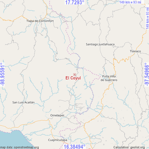
El Coyul GPS coordinates[2]
17° 3' 29.988" North, 98° 15' 10.008" West
| Map corner | latitude | longitude |
|---|---|---|
| Upper-left | 17.7293°, | -98.95591° |
| Center: | 17.05833°, | -98.25278° |
| Lower-right: | 16.38494°, | -97.54966° |
| Map W x H: | 149.5×149.5 km | = 92.9×92.9mi |
| max Lat: | 32.7° ⇑88.1% North |
| El Coyul: | 17.05833° |
| min Lat: | ⇓11.9% South 14.53588° |
| min Long | El Coyul | max Long |
| -117.105° | -98.25278° | -86.73105° |
| W 60.5%⇐ | ⇒39.5% E |
Elevation
Elevation of El Coyul is 935 m = 3068 ft, and this is 318.7 m = 1046 ft below average elevation for this country.
| Max E: |
3497 m = 11473 ft | 61.1% |
| Avg. | 1253.7 m = 4113 ft | |
| El Coyul | 935 m = 3068 ft | |
Min E: |
-1 m = -3 ft | 38.9% |
See also: Mexico elevation on elevation.city.
Geographical zone
El Coyul is located in North Torrid zone (between Equator and Tropic of Cancer). Distance of this Northern Tropic circle is 709.2 km =440.7 mi to North.| Distance of | km | miles | from El Coyul |
|---|---|---|---|
| North Pole | 8110.4 | 5039.6 | to North |
| Arctic Circle | 5504.5 | 3420.3 | to North |
| Tropic Cancer | 709.2 | 440.7 | to North |
| Equator | 1896.7 | 1178.6 | to South |


Nearby cities:
15 places around El Coyul: (largest is in red/bold)
• Arroyo Prieto
6.5 km =4 mi,  284°
284°
• Coyul
14.6 km =9.1 mi,  24°
24°
• El Carmen
12.1 km =7.5 mi,  172°
172°
• El Jicaral
9.6 km =6 mi,  38°
38°
• El Limón Guadalupe
9.4 km =5.8 mi,  9°
9°
• Jicayán de Tovar
7.9 km =4.9 mi, 12°
• Joya Real
14.5 km =9 mi, 280°
• La Trinidad
7.5 km =4.7 mi,  76°
76°
• Rancho Viejo (Rancho Nuevo de la Democracia)
4.2 km =2.6 mi,  133°
133°
• Río Encajonado
6.8 km =4.2 mi,  254°
254°
• San Pedro Cuitlapan
9.5 km =5.9 mi,  179°
179°
• Santa Cruz Yucucani
15 km =9.3 mi, 82°
• Terrero Venado
15.8 km =9.8 mi,  214°
214°
• Tierra Colorada
12 km =7.5 mi,  29°
29°
• Yoloxóchitl (Santiago Yoloxóchitl)
6.7 km =4.2 mi,  150°
150°
Sources, notices
• [Note1] Compared only with cities in Mexico existing in our database
• [Src1] Map data: © OpenStreetMap contributors (CC-BY-SA)
• [Src2] Other city data from geonames.org with taken over terms of usage.
• [Src3] Geographical zone / Annual Mean Temperature by Robert A. Rohde @ Wikipedia
