Uspibil geodata
Uspibil (Yucatán) is a populated place; located in Mexico in America/Merida (GMT-6) time zone. With population of 890 people, there are 9797 cities with bigger population in this country. Compared to other cities in Mexico, 72.8% of cities are located further ↓South; 99.7% of cities are located further ←West and 91.2% of cities have higher elevation than Uspibil. Note1


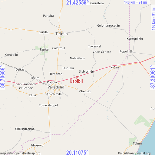
Uspibil GPS coordinates[2]
20° 46' 10.56" North, 88° 0' 13.428" West
| Map corner | latitude | longitude |
|---|---|---|
| Upper-left | 21.42559°, | -88.70686° |
| Center: | 20.7696°, | -88.00373° |
| Lower-right: | 20.11075°, | -87.30061° |
| Map W x H: | 146.2×146.2 km | = 90.8×90.8mi |
| max Lat: | 32.7° ⇑27.2% North |
| Uspibil: | 20.7696° |
| min Lat: | ⇓72.8% South 14.53588° |
| min Long | Uspibil | max Long |
| -117.105° | -88.00373° | -86.73105° |
| W 99.7%⇐ | ⇒0.3% E |
Elevation
Elevation of Uspibil is 21 m = 69 ft, and this is 1232.7 m = 4044 ft below average elevation for this country.
| Max E: |
3497 m = 11473 ft | 91.2% |
| Avg. | 1253.7 m = 4113 ft | |
| Uspibil | 21 m = 69 ft | |
Min E: |
-1 m = -3 ft | 8.8% |
See also: Mexico elevation on elevation.city.
Geographical zone
Uspibil is located in North Torrid zone (between Equator and Tropic of Cancer). Distance of this Northern Tropic circle is 296.6 km =184.3 mi to North.| Distance of | km | miles | from Uspibil |
|---|---|---|---|
| North Pole | 7697.7 | 4783.1 | to North |
| Arctic Circle | 5091.8 | 3163.9 | to North |
| Tropic Cancer | 296.6 | 184.3 | to North |
| Equator | 2309.4 | 1435 | to South |


Nearby cities:
15 places around Uspibil: (largest is in red/bold)
• Chechmil
4.1 km =2.5 mi,  85°
85°
• Chemax
14.4 km =8.9 mi,  150°
150°
• Chulutan
22.8 km =14.2 mi,  169°
169°
• Dzalbay
8.8 km =5.5 mi,  324°
324°
• Hunuku
12.8 km =8 mi, 315°
• Kanxoc
19.7 km =12.2 mi,  209°
209°
• Kuxeb
17.1 km =10.6 mi,  54°
54°
• Tahmuy
14.4 km =8.9 mi,  265°
265°
• Temozon
20.9 km =13 mi,  280°
280°
• Tesoco
16.5 km =10.3 mi,  251°
251°
• Tikuch
13.5 km =8.4 mi,  236°
236°
• Tixhualactún
20.1 km =12.5 mi,  226°
226°
• Valladolid
22.3 km =13.9 mi, 245°
• Xmuquel
22.3 km =13.9 mi, 50°
• Yalkoba
4.2 km =2.6 mi,  305°
305°
Sources, notices
• [Note1] Compared only with cities in Mexico existing in our database
• [Src1] Map data: © OpenStreetMap contributors (CC-BY-SA)
• [Src2] Other city data from geonames.org with taken over terms of usage.
• [Src3] Geographical zone / Annual Mean Temperature by Robert A. Rohde @ Wikipedia
