Hunuku geodata
Hunuku (Yucatán) is a populated place; located in Mexico in America/Merida (GMT-6) time zone. With population of 2,971 people, there are 3015 cities with bigger population in this country. Compared to other cities in Mexico, 74% of cities are located further ↓South; 99.7% of cities are located further ←West and 90.8% of cities have higher elevation than Hunuku. Note1


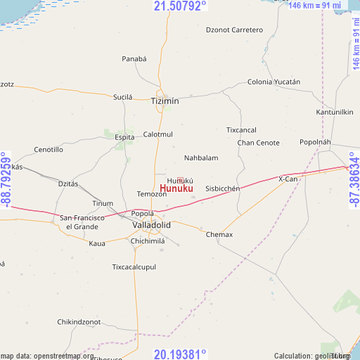
Hunuku GPS coordinates[2]
20° 51' 8.28" North, 88° 5' 22.056" West
| Map corner | latitude | longitude |
|---|---|---|
| Upper-left | 21.50792°, | -88.79259° |
| Center: | 20.8523°, | -88.08946° |
| Lower-right: | 20.19381°, | -87.38634° |
| Map W x H: | 146.1×146.1 km | = 90.8×90.8mi |
| max Lat: | 32.7° ⇑26% North |
| Hunuku: | 20.8523° |
| min Lat: | ⇓74% South 14.53588° |
| min Long | Hunuku | max Long |
| -117.105° | -88.08946° | -86.73105° |
| W 99.7%⇐ | ⇒0.3% E |
Elevation
Elevation of Hunuku is 22 m = 72 ft, and this is 1231.7 m = 4041 ft below average elevation for this country.
| Max E: |
3497 m = 11473 ft | 90.8% |
| Avg. | 1253.7 m = 4113 ft | |
| Hunuku | 22 m = 72 ft | |
Min E: |
-1 m = -3 ft | 9.2% |
See also: Mexico elevation on elevation.city.
Geographical zone
Hunuku is located in North Torrid zone (between Equator and Tropic of Cancer). Distance of this Northern Tropic circle is 287.4 km =178.6 mi to North.| Distance of | km | miles | from Hunuku |
|---|---|---|---|
| North Pole | 7688.5 | 4777.4 | to North |
| Arctic Circle | 5082.6 | 3158.2 | to North |
| Tropic Cancer | 287.4 | 178.6 | to North |
| Equator | 2318.6 | 1440.7 | to South |


Nearby cities:
15 places around Hunuku: (largest is in red/bold)
• Calotmul
20.8 km =12.9 mi,  334°
334°
• Chechmil
15.7 km =9.8 mi,  124°
124°
• Dzalbay
4.3 km =2.7 mi, 117°
• Kunche
23.1 km =14.4 mi,  286°
286°
• Kuxeb
22.9 km =14.2 mi,  88°
88°
• Nacuche
22.9 km =14.2 mi, 290°
• Pocoboch
13.9 km =8.6 mi,  349°
349°
• Popola
20.3 km =12.6 mi,  229°
229°
• Tahmuy
11.7 km =7.3 mi,  207°
207°
• Temozon
12.8 km =8 mi,  245°
245°
• Tesoco
15.9 km =9.9 mi, 205°
• Tikuch
16.8 km =10.4 mi,  188°
188°
• Uspibil
12.8 km =8 mi,  135°
135°
• Valladolid
21.5 km =13.4 mi, 212°
• Yalkoba
8.7 km =5.4 mi, 140°
Sources, notices
• [Note1] Compared only with cities in Mexico existing in our database
• [Src1] Map data: © OpenStreetMap contributors (CC-BY-SA)
• [Src2] Other city data from geonames.org with taken over terms of usage.
• [Src3] Geographical zone / Annual Mean Temperature by Robert A. Rohde @ Wikipedia
