San José Pastorías geodata
San José Pastorías (Veracruz) is a populated place; located in Mexico in America/Mexico_City (GMT-6) time zone. With population of 620 people, there are 13925 cities with bigger population in this country. Compared to other cities in Mexico, 52.8% of cities are located further ↑North; 79.3% of cities are located further ←West and 74% of cities have higher elevation than San José Pastorías. Note1


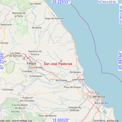
San José Pastorías GPS coordinates[2]
19° 33' 51.012" North, 96° 34' 14.016" West
| Map corner | latitude | longitude |
|---|---|---|
| Upper-left | 20.22533°, | -97.27369° |
| Center: | 19.56417°, | -96.57056° |
| Lower-right: | 18.90029°, | -95.86744° |
| Map W x H: | 147.3×147.3 km | = 91.5×91.5mi |
| max Lat: | 32.7° ⇑52.8% North |
| San José Pastorías: | 19.56417° |
| min Lat: | ⇓47.2% South 14.53588° |
| min Long | San José Pasto | max Long |
| -117.105° | -96.57056° | -86.73105° |
| W 79.3%⇐ | ⇒20.7% E |
Elevation
Elevation of San José Pastorías is 257 m = 843 ft, and this is 996.7 m = 3270 ft below average elevation for this country.
| Max E: |
3497 m = 11473 ft | 74% |
| Avg. | 1253.7 m = 4113 ft | |
| San José Pastorías | 257 m = 843 ft | |
Min E: |
-1 m = -3 ft | 26% |
See also: Mexico elevation on elevation.city.
Geographical zone
San José Pastorías is located in North Torrid zone (between Equator and Tropic of Cancer). Distance of this Northern Tropic circle is 430.6 km =267.6 mi to North.| Distance of | km | miles | from San José Pastorías |
|---|---|---|---|
| North Pole | 7831.7 | 4866.4 | to North |
| Arctic Circle | 5225.8 | 3247.2 | to North |
| Tropic Cancer | 430.6 | 267.6 | to North |
| Equator | 2175.3 | 1351.7 | to South |


Nearby cities:
15 places around San José Pastorías: (largest is in red/bold)
• Actopan
8.2 km =5.1 mi,  215°
215°
• Blanca Espuma
12.5 km =7.8 mi,  278°
278°
• Cerro Gordo
8.2 km =5.1 mi,  274°
274°
• Chicuasen
11.4 km =7.1 mi,  249°
249°
• Flor Blanca
6 km =3.7 mi,  233°
233°
• La Esperanza
9.6 km =6 mi,  173°
173°
• La Reforma
7.5 km =4.7 mi,  298°
298°
• Mesa de Guadalupe
13.5 km =8.4 mi, 269°
• Mozomboa
11.8 km =7.3 mi,  124°
124°
• Palmas de Abajo
14.3 km =8.9 mi,  78°
78°
• Ranchito de las Ánimas
9.6 km =6 mi,  239°
239°
• Santa Rosa
15.2 km =9.4 mi,  133°
133°
• Tinajitas
14.7 km =9.1 mi,  65°
65°
• Villa Nueva
11.1 km =6.9 mi, 241°
• Zoyacuautla
1.5 km =0.9 mi,  332°
332°
Sources, notices
• [Note1] Compared only with cities in Mexico existing in our database
• [Src1] Map data: © OpenStreetMap contributors (CC-BY-SA)
• [Src2] Other city data from geonames.org with taken over terms of usage.
• [Src3] Geographical zone / Annual Mean Temperature by Robert A. Rohde @ Wikipedia
