La Esperanza geodata
La Esperanza (Veracruz) is a populated place; located in Mexico in America/Mexico_City (GMT-6) time zone. With population of 646 people, there are 13395 cities with bigger population in this country. Compared to other cities in Mexico, 54.5% of cities are located further ↑North; 79.3% of cities are located further ←West and 76.4% of cities have higher elevation than La Esperanza. Note1


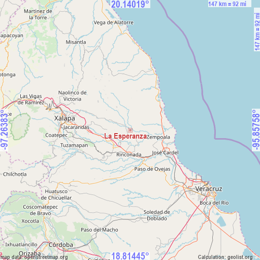
La Esperanza GPS coordinates[2]
19° 28' 43.248" North, 96° 33' 38.52" West
| Map corner | latitude | longitude |
|---|---|---|
| Upper-left | 20.14019°, | -97.26383° |
| Center: | 19.47868°, | -96.5607° |
| Lower-right: | 18.81445°, | -95.85758° |
| Map W x H: | 147.4×147.4 km | = 91.6×91.6mi |
| max Lat: | 32.7° ⇑54.5% North |
| La Esperanza: | 19.47868° |
| min Lat: | ⇓45.5% South 14.53588° |
| min Long | La Esperanza | max Long |
| -117.105° | -96.5607° | -86.73105° |
| W 79.3%⇐ | ⇒20.7% E |
Elevation
Elevation of La Esperanza is 170 m = 558 ft, and this is 1083.7 m = 3555 ft below average elevation for this country.
| Max E: |
3497 m = 11473 ft | 76.4% |
| Avg. | 1253.7 m = 4113 ft | |
| La Esperanza | 170 m = 558 ft | |
Min E: |
-1 m = -3 ft | 23.6% |
See also: Mexico elevation on elevation.city.
Geographical zone
La Esperanza is located in North Torrid zone (between Equator and Tropic of Cancer). Distance of this Northern Tropic circle is 440.1 km =273.5 mi to North.| Distance of | km | miles | from La Esperanza |
|---|---|---|---|
| North Pole | 7841.2 | 4872.3 | to North |
| Arctic Circle | 5235.3 | 3253.1 | to North |
| Tropic Cancer | 440.1 | 273.5 | to North |
| Equator | 2165.8 | 1345.8 | to South |


Nearby cities:
15 places around La Esperanza: (largest is in red/bold)
• Actopan
6.5 km =4 mi,  295°
295°
• Buena Vista
8.4 km =5.2 mi,  178°
178°
• El Aguaje
9 km =5.6 mi,  220°
220°
• Flor Blanca
8.4 km =5.2 mi,  315°
315°
• Jareros
9.8 km =6.1 mi,  111°
111°
• Los Ídolos
8.7 km =5.4 mi,  149°
149°
• Mozomboa
9.2 km =5.7 mi,  71°
71°
• Palo Gacho
12.6 km =7.8 mi, 219°
• Paso de la Milpa
7.9 km =4.9 mi, 223°
• Plan del Río
12.9 km =8 mi,  228°
228°
• Ranchito de las Ánimas
10.4 km =6.5 mi, 296°
• San José Pastorías
9.6 km =6 mi,  353°
353°
• Santa Rosa
10.1 km =6.3 mi,  95°
95°
• Villa Nueva
11.5 km =7.1 mi,  291°
291°
• Zoyacuautla
11 km =6.8 mi, 350°
Sources, notices
• [Note1] Compared only with cities in Mexico existing in our database
• [Src1] Map data: © OpenStreetMap contributors (CC-BY-SA)
• [Src2] Other city data from geonames.org with taken over terms of usage.
• [Src3] Geographical zone / Annual Mean Temperature by Robert A. Rohde @ Wikipedia
