Loma Fina (Loma Pelona) geodata
Loma Fina (Loma Pelona) (Veracruz) is a populated place; located in Mexico in America/Mexico_City (GMT-6) time zone. With population of 623 people, there are 13874 cities with bigger population in this country. Compared to other cities in Mexico, 59.6% of cities are located further ↑North; 80.2% of cities are located further ←West and 87.7% of cities have higher elevation than Loma Fina (Loma Pelona). Note1
Current local time in Loma Fina (Loma Pelona):
10:07 AM, MondayDifference from your time zone: hours


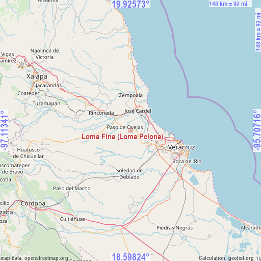
Loma Fina (Loma Pelona) GPS coordinates[2]
19° 15' 47.988" North, 96° 24' 37.008" West
| Map corner | latitude | longitude |
|---|---|---|
| Upper-left | 19.92573°, | -97.11341° |
| Center: | 19.26333°, | -96.41028° |
| Lower-right: | 18.59824°, | -95.70716° |
| Map W x H: | 147.6×147.6 km | = 91.7×91.7mi |
| max Lat: | 32.7° ⇑59.6% North |
| Loma Fina (Loma Pelona): | 19.26333° |
| min Lat: | ⇓40.4% South 14.53588° |
| min Long | Loma Fina (Loma | max Long |
| -117.105° | -96.41028° | -86.73105° |
| W 80.2%⇐ | ⇒19.8% E |
Elevation
Elevation of Loma Fina (Loma Pelona) is 31 m = 102 ft, and this is 1222.7 m = 4011 ft below average elevation for this country.
| Max E: |
3497 m = 11473 ft | 87.7% |
| Avg. | 1253.7 m = 4113 ft | |
| Loma Fina (Loma Pelona) | 31 m = 102 ft | |
Min E: |
-1 m = -3 ft | 12.3% |
See also: Mexico elevation on elevation.city.
Geographical zone
Loma Fina (Loma Pelona) is located in North Torrid zone (between Equator and Tropic of Cancer). Distance of this Northern Tropic circle is 464 km =288.3 mi to North.| Distance of | km | miles | from Loma Fina (Loma Pelona) |
|---|---|---|---|
| North Pole | 7865.2 | 4887.2 | to North |
| Arctic Circle | 5259.3 | 3268 | to North |
| Tropic Cancer | 464 | 288.3 | to North |
| Equator | 2141.9 | 1330.9 | to South |


Nearby cities:
15 places around Loma Fina (Loma Pelona): (largest is in red/bold)
• Bandera de Juárez
7.3 km =4.5 mi,  190°
190°
• Cerro Guzmán
4.6 km =2.9 mi,  132°
132°
• El Hatito
2.4 km =1.5 mi,  47°
47°
• El Mango
7.1 km =4.4 mi,  20°
20°
• El Pochote
4.9 km =3 mi,  170°
170°
• La Ceiba
6.5 km =4 mi,  26°
26°
• Loma del Nanche
7.4 km =4.6 mi,  158°
158°
• Palmaritos
4.7 km =2.9 mi,  180°
180°
• Paso de Ovejas
3.9 km =2.4 mi,  306°
306°
• Plan del Manantial
6.2 km =3.9 mi,  141°
141°
• Puente Jula
9.6 km =6 mi, 137°
• Pureza
10.1 km =6.3 mi,  76°
76°
• Tierra Colorada
6 km =3.7 mi, 134°
• Tolome
1.7 km =1.1 mi, 77°
• Vargas
10.2 km =6.3 mi,  112°
112°
Sources, notices
• [Note1] Compared only with cities in Mexico existing in our database
• [Src1] Map data: © OpenStreetMap contributors (CC-BY-SA)
• [Src2] Other city data from geonames.org with taken over terms of usage.
• [Src3] Geographical zone / Annual Mean Temperature by Robert A. Rohde @ Wikipedia
