Veinte de Noviembre geodata
Veinte de Noviembre (Veracruz) is a populated place; located in Mexico in America/Mexico_City (GMT-6) time zone. With population of 1,351 people, there are 6439 cities with bigger population in this country. Compared to other cities in Mexico, 67.7% of cities are located further ↑North; 75.5% of cities are located further ←West and 62.4% of cities have higher elevation than Veinte de Noviembre. Note1


Veinte de Noviembre GPS coordinates[2]
18° 51' 54" North, 96° 57' 16.992" West
| Map corner | latitude | longitude |
|---|---|---|
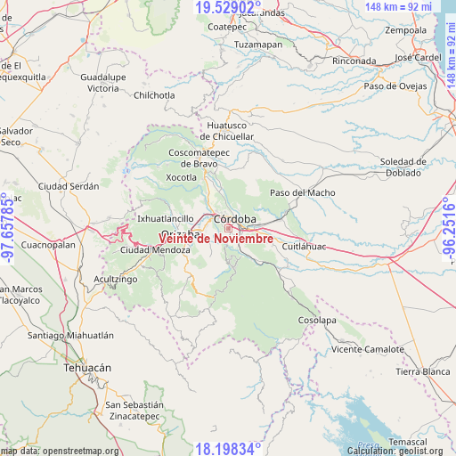
| Upper-left | 19.52902°, | -97.65785° |
| Center: | 18.865°, | -96.95472° |
| Lower-right: | 18.19834°, | -96.2516° |
| Map W x H: | 148×148 km | = 92×92mi |
| max Lat: | 32.7° ⇑67.7% North |
| Veinte de Noviembre: | 18.865° |
| min Lat: | ⇓32.3% South 14.53588° |
| min Long | Veinte de Novie | max Long |
| -117.105° | -96.95472° | -86.73105° |
| W 75.5%⇐ | ⇒24.5% E |
Elevation
Elevation of Veinte de Noviembre is 861 m = 2825 ft, and this is 392.7 m = 1288 ft below average elevation for this country.
| Max E: |
3497 m = 11473 ft | 62.4% |
| Avg. | 1253.7 m = 4113 ft | |
| Veinte de Noviembre | 861 m = 2825 ft | |
Min E: |
-1 m = -3 ft | 37.6% |
See also: Mexico elevation on elevation.city.
Geographical zone
Veinte de Noviembre is located in North Torrid zone (between Equator and Tropic of Cancer). Distance of this Northern Tropic circle is 508.3 km =315.8 mi to North.| Distance of | km | miles | from Veinte de Noviembre |
|---|---|---|---|
| North Pole | 7909.5 | 4914.7 | to North |
| Arctic Circle | 5303.6 | 3295.5 | to North |
| Tropic Cancer | 508.3 | 315.8 | to North |
| Equator | 2097.6 | 1303.4 | to South |


Nearby cities:
15 places around Veinte de Noviembre: (largest is in red/bold)
• Agustín Millán
4.3 km =2.7 mi,  57°
57°
• Amatlán de los Reyes
4.6 km =2.9 mi,  116°
116°
• Centro de Readaptación Social
3.4 km =2.1 mi,  151°
151°
• Coapichapan (Barranca de San Miguel)
5.5 km =3.4 mi,  295°
295°
• Colorines
3.3 km =2.1 mi,  311°
311°
• Córdoba
3.7 km =2.3 mi, 55°
• Córdoba (Santa Leticia)
5.5 km =3.4 mi,  332°
332°
• El Pueblito
2.8 km =1.7 mi, 326°
• Fredepo
2.9 km =1.8 mi, 306°
• Residencial Cecadys
5.1 km =3.2 mi,  354°
354°
• San José de Tapia
2 km =1.2 mi,  177°
177°
• Trapiche Viejo
2.6 km =1.6 mi,  158°
158°
• Villa Unión
3.1 km =1.9 mi,  247°
247°
• Zacatepec
1.1 km =0.7 mi,  30°
30°
• Zapoapan
4.9 km =3 mi,  235°
235°
Sources, notices
• [Note1] Compared only with cities in Mexico existing in our database
• [Src1] Map data: © OpenStreetMap contributors (CC-BY-SA)
• [Src2] Other city data from geonames.org with taken over terms of usage.
• [Src3] Geographical zone / Annual Mean Temperature by Robert A. Rohde @ Wikipedia
