Agustín Millán geodata
Agustín Millán (Veracruz) is a populated place; located in Mexico in America/Mexico_City (GMT-6) time zone. With population of 579 people, there are 14804 cities with bigger population in this country. Compared to other cities in Mexico, 67.3% of cities are located further ↑North; 75.9% of cities are located further ←West and 62.9% of cities have higher elevation than Agustín Millán. Note1


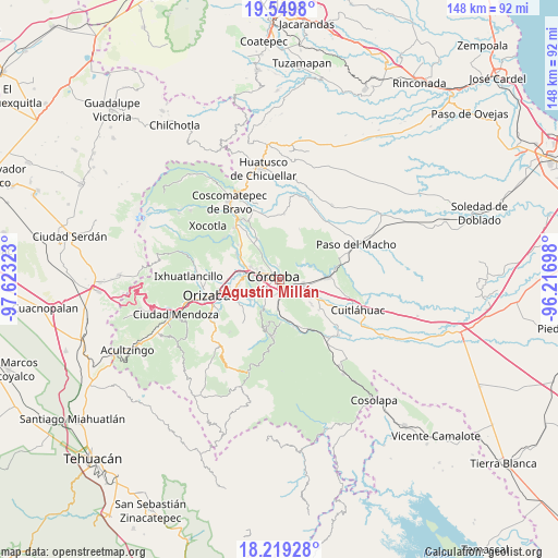
Agustín Millán GPS coordinates[2]
18° 53' 9.096" North, 96° 55' 12.36" West
| Map corner | latitude | longitude |
|---|---|---|
| Upper-left | 19.5498°, | -97.62323° |
| Center: | 18.88586°, | -96.9201° |
| Lower-right: | 18.21928°, | -96.21698° |
| Map W x H: | 147.9×147.9 km | = 91.9×91.9mi |
| max Lat: | 32.7° ⇑67.3% North |
| Agustín Millán: | 18.88586° |
| min Lat: | ⇓32.7% South 14.53588° |
| min Long | Agustín Millá | max Long |
| -117.105° | -96.9201° | -86.73105° |
| W 75.9%⇐ | ⇒24.1% E |
Elevation
Elevation of Agustín Millán is 824 m = 2703 ft, and this is 429.7 m = 1410 ft below average elevation for this country.
| Max E: |
3497 m = 11473 ft | 62.9% |
| Avg. | 1253.7 m = 4113 ft | |
| Agustín Millán | 824 m = 2703 ft | |
Min E: |
-1 m = -3 ft | 37.1% |
See also: Mexico elevation on elevation.city.
Geographical zone
Agustín Millán is located in North Torrid zone (between Equator and Tropic of Cancer). Distance of this Northern Tropic circle is 506 km =314.4 mi to North.| Distance of | km | miles | from Agustín Millán |
|---|---|---|---|
| North Pole | 7907.2 | 4913.3 | to North |
| Arctic Circle | 5301.3 | 3294.1 | to North |
| Tropic Cancer | 506 | 314.4 | to North |
| Equator | 2099.9 | 1304.8 | to South |


Nearby cities:
15 places around Agustín Millán: (largest is in red/bold)
• Amatlán de los Reyes
4.4 km =2.7 mi,  174°
174°
• Berlín
3.6 km =2.2 mi,  356°
356°
• Centro de Readaptación Social
5.7 km =3.5 mi,  200°
200°
• Cuauhtémoc
2.8 km =1.7 mi,  118°
118°
• Córdoba
0.6 km =0.4 mi,  252°
252°
• El Porvenir
3.9 km =2.4 mi,  351°
351°
• El Pueblito
5.2 km =3.2 mi,  270°
270°
• Peñuela
3.7 km =2.3 mi,  130°
130°
• Residencial Cecadys
5 km =3.1 mi,  304°
304°
• San José de Tapia
5.6 km =3.5 mi,  219°
219°
• San Matías
3.1 km =1.9 mi, 351°
• San Rafael Río Seco
4.2 km =2.6 mi,  104°
104°
• Trapiche Viejo
5.5 km =3.4 mi,  209°
209°
• Veinte de Noviembre
4.3 km =2.7 mi,  237°
237°
• Zacatepec
3.3 km =2.1 mi, 246°
Sources, notices
• [Note1] Compared only with cities in Mexico existing in our database
• [Src1] Map data: © OpenStreetMap contributors (CC-BY-SA)
• [Src2] Other city data from geonames.org with taken over terms of usage.
• [Src3] Geographical zone / Annual Mean Temperature by Robert A. Rohde @ Wikipedia
