Villa Unión geodata
Villa Unión (Veracruz) is a populated place; located in Mexico in America/Mexico_City (GMT-6) time zone. With population of 1,213 people, there are 7176 cities with bigger population in this country. Compared to other cities in Mexico, 67.9% of cities are located further ↑North; 75.1% of cities are located further ←West and 62.6% of cities have higher elevation than Villa Unión. Note1


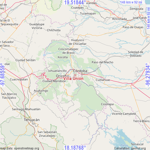
Villa Unión GPS coordinates[2]
18° 51' 15.768" North, 96° 58' 56.856" West
| Map corner | latitude | longitude |
|---|---|---|
| Upper-left | 19.51844°, | -97.68559° |
| Center: | 18.85438°, | -96.98246° |
| Lower-right: | 18.18768°, | -96.27934° |
| Map W x H: | 148×148 km | = 92×92mi |
| max Lat: | 32.7° ⇑67.9% North |
| Villa Unión: | 18.85438° |
| min Lat: | ⇓32.1% South 14.53588° |
| min Long | Villa Unión | max Long |
| -117.105° | -96.98246° | -86.73105° |
| W 75.1%⇐ | ⇒24.9% E |
Elevation
Elevation of Villa Unión is 843 m = 2766 ft, and this is 410.7 m = 1347 ft below average elevation for this country.
| Max E: |
3497 m = 11473 ft | 62.6% |
| Avg. | 1253.7 m = 4113 ft | |
| Villa Unión | 843 m = 2766 ft | |
Min E: |
-1 m = -3 ft | 37.4% |
See also: Mexico elevation on elevation.city.
Geographical zone
Villa Unión is located in North Torrid zone (between Equator and Tropic of Cancer). Distance of this Northern Tropic circle is 509.5 km =316.6 mi to North.| Distance of | km | miles | from Villa Unión |
|---|---|---|---|
| North Pole | 7910.7 | 4915.5 | to North |
| Arctic Circle | 5304.8 | 3296.2 | to North |
| Tropic Cancer | 509.5 | 316.6 | to North |
| Equator | 2096.4 | 1302.6 | to South |


Nearby cities:
15 places around Villa Unión: (largest is in red/bold)
• Campo Chico
5.2 km =3.2 mi,  247°
247°
• Campo Grande
4.7 km =2.9 mi,  222°
222°
• Centro de Readaptación Social
4.9 km =3 mi,  111°
111°
• Coapichapan (Barranca de San Miguel)
4.1 km =2.5 mi,  330°
330°
• Colorines
3.4 km =2.1 mi,  7°
7°
• Cuautlapán
5 km =3.1 mi,  301°
301°
• El Pueblito
3.8 km =2.4 mi,  21°
21°
• Fredepo
3 km =1.9 mi, 11°
• Fresnal
4.1 km =2.5 mi,  180°
180°
• San José de Tapia
3.1 km =1.9 mi,  104°
104°
• Trapiche Viejo
4.1 km =2.5 mi, 107°
• Veinte de Noviembre
3.1 km =1.9 mi,  67°
67°
• Villa Libertad
5.2 km =3.2 mi,  148°
148°
• Zacatepec
4.1 km =2.5 mi,  58°
58°
• Zapoapan
1.9 km =1.2 mi, 215°
Sources, notices
• [Note1] Compared only with cities in Mexico existing in our database
• [Src1] Map data: © OpenStreetMap contributors (CC-BY-SA)
• [Src2] Other city data from geonames.org with taken over terms of usage.
• [Src3] Geographical zone / Annual Mean Temperature by Robert A. Rohde @ Wikipedia
