Ixhuapan geodata
Ixhuapan (Veracruz) is a populated place; located in Mexico in America/Mexico_City (GMT-6) time zone. With population of 1,356 people, there are 6414 cities with bigger population in this country. Compared to other cities in Mexico, 78.5% of cities are located further ↑North; 84.9% of cities are located further ←West and 80.5% of cities have higher elevation than Ixhuapan. Note1


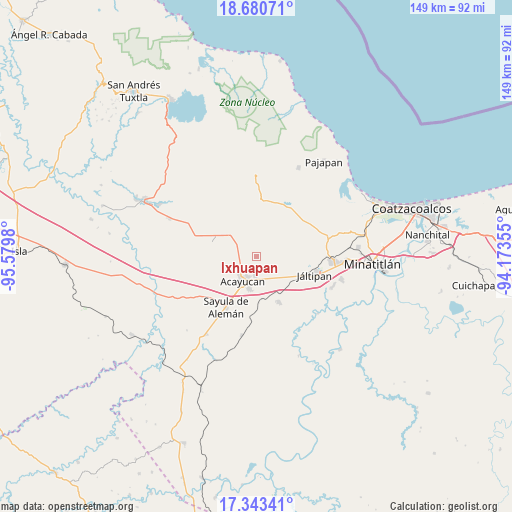
Ixhuapan GPS coordinates[2]
18° 0' 47.988" North, 94° 52' 36.012" West
| Map corner | latitude | longitude |
|---|---|---|
| Upper-left | 18.68071°, | -95.5798° |
| Center: | 18.01333°, | -94.87667° |
| Lower-right: | 17.34341°, | -94.17355° |
| Map W x H: | 148.7×148.7 km | = 92.4×92.4mi |
| max Lat: | 32.7° ⇑78.5% North |
| Ixhuapan: | 18.01333° |
| min Lat: | ⇓21.5% South 14.53588° |
| min Long | Ixhuapan | max Long |
| -117.105° | -94.87667° | -86.73105° |
| W 84.9%⇐ | ⇒15.1% E |
Elevation
Elevation of Ixhuapan is 88 m = 289 ft, and this is 1165.7 m = 3824 ft below average elevation for this country.
| Max E: |
3497 m = 11473 ft | 80.5% |
| Avg. | 1253.7 m = 4113 ft | |
| Ixhuapan | 88 m = 289 ft | |
Min E: |
-1 m = -3 ft | 19.5% |
See also: Mexico elevation on elevation.city.
Geographical zone
Ixhuapan is located in North Torrid zone (between Equator and Tropic of Cancer). Distance of this Northern Tropic circle is 603 km =374.7 mi to North.| Distance of | km | miles | from Ixhuapan |
|---|---|---|---|
| North Pole | 8004.2 | 4973.6 | to North |
| Arctic Circle | 5398.3 | 3354.3 | to North |
| Tropic Cancer | 603 | 374.7 | to North |
| Equator | 2002.9 | 1244.5 | to South |


Nearby cities:
15 places around Ixhuapan: (largest is in red/bold)
• Acayucan
8.1 km =5 mi,  209°
209°
• Cirilo Vázquez Lagunes
5.3 km =3.3 mi,  236°
236°
• Colonia Lealtad
6.2 km =3.9 mi, 206°
• Comején
5.4 km =3.4 mi,  350°
350°
• El Hato
9.2 km =5.7 mi,  258°
258°
• Fraccionamiento Santa Cruz
5 km =3.1 mi,  202°
202°
• Francisco I. Madero
7.6 km =4.7 mi,  156°
156°
• Hipólito Landeros (Zacatal)
8.8 km =5.5 mi,  131°
131°
• Ixtagapa
8.2 km =5.1 mi,  305°
305°
• Monte Grande
4.3 km =2.7 mi,  337°
337°
• Oluta
9.5 km =5.9 mi,  192°
192°
• Pitalillo
9 km =5.6 mi,  331°
331°
• San Andrés Chamilpa
9.1 km =5.7 mi,  15°
15°
• Soconusco
5.6 km =3.5 mi,  184°
184°
• Tecuanapa
4 km =2.5 mi, 255°
Sources, notices
• [Note1] Compared only with cities in Mexico existing in our database
• [Src1] Map data: © OpenStreetMap contributors (CC-BY-SA)
• [Src2] Other city data from geonames.org with taken over terms of usage.
• [Src3] Geographical zone / Annual Mean Temperature by Robert A. Rohde @ Wikipedia
