San Andrés Chamilpa geodata
San Andrés Chamilpa (Veracruz) is a populated place; located in Mexico in America/Mexico_City (GMT-6) time zone. With population of 651 people, there are 13306 cities with bigger population in this country. Compared to other cities in Mexico, 77.7% of cities are located further ↑North; 84.9% of cities are located further ←West and 79.6% of cities have higher elevation than San Andrés Chamilpa. Note1


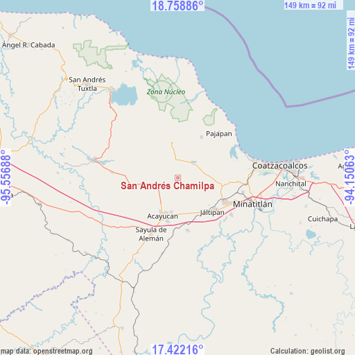
San Andrés Chamilpa GPS coordinates[2]
18° 5' 30.408" North, 94° 51' 13.5" West
| Map corner | latitude | longitude |
|---|---|---|
| Upper-left | 18.75886°, | -95.55688° |
| Center: | 18.09178°, | -94.85375° |
| Lower-right: | 17.42216°, | -94.15063° |
| Map W x H: | 148.6×148.6 km | = 92.3×92.3mi |
| max Lat: | 32.7° ⇑77.7% North |
| San Andrés Chamilpa: | 18.09178° |
| min Lat: | ⇓22.3% South 14.53588° |
| min Long | San Andrés Cha | max Long |
| -117.105° | -94.85375° | -86.73105° |
| W 84.9%⇐ | ⇒15.1% E |
Elevation
Elevation of San Andrés Chamilpa is 101 m = 331 ft, and this is 1152.7 m = 3782 ft below average elevation for this country.
| Max E: |
3497 m = 11473 ft | 79.6% |
| Avg. | 1253.7 m = 4113 ft | |
| San Andrés Chamilpa | 101 m = 331 ft | |
Min E: |
-1 m = -3 ft | 20.4% |
See also: Mexico elevation on elevation.city.
Geographical zone
San Andrés Chamilpa is located in North Torrid zone (between Equator and Tropic of Cancer). Distance of this Northern Tropic circle is 594.3 km =369.3 mi to North.| Distance of | km | miles | from San Andrés Chamilpa |
|---|---|---|---|
| North Pole | 7995.4 | 4968.1 | to North |
| Arctic Circle | 5389.6 | 3348.9 | to North |
| Tropic Cancer | 594.3 | 369.3 | to North |
| Equator | 2011.6 | 1249.9 | to South |


Nearby cities:
15 places around San Andrés Chamilpa: (largest is in red/bold)
• Amamaloya
8 km =5 mi,  37°
37°
• Cerro de la Palma
8.3 km =5.2 mi,  13°
13°
• Comején
4.8 km =3 mi,  224°
224°
• Cuilonia Nuevo
9.5 km =5.9 mi,  317°
317°
• El Naranjo
10 km =6.2 mi,  59°
59°
• Huazuntlán
9.7 km =6 mi, 41°
• Ixhuapan
9.1 km =5.7 mi,  195°
195°
• Ixtagapa
9.9 km =6.2 mi,  246°
246°
• La Estribera
4.6 km =2.9 mi,  307°
307°
• Las Palomas (Bajo Paloma)
7.9 km =4.9 mi, 320°
• Monte Grande
6.3 km =3.9 mi, 220°
• Pitalillo
6.8 km =4.2 mi,  262°
262°
• Saltillo
7.5 km =4.7 mi,  0°
0°
• San Miguel
10.9 km =6.8 mi, 258°
• Tonalapa
9.1 km =5.7 mi,  45°
45°
Sources, notices
• [Note1] Compared only with cities in Mexico existing in our database
• [Src1] Map data: © OpenStreetMap contributors (CC-BY-SA)
• [Src2] Other city data from geonames.org with taken over terms of usage.
• [Src3] Geographical zone / Annual Mean Temperature by Robert A. Rohde @ Wikipedia
