Congregación Hidalgo geodata
Congregación Hidalgo (Veracruz) is a populated place; located in Mexico in America/Mexico_City (GMT-6) time zone. With population of 1,370 people, there are 6336 cities with bigger population in this country. Compared to other cities in Mexico, 79.3% of cities are located further ↑North; 84.7% of cities are located further ←West and 81% of cities have higher elevation than Congregación Hidalgo. Note1
Current local time in Congregación Hidalgo:
08:32 AM, WednesdayDifference from your time zone: hours


Congregación Hidalgo GPS coordinates[2]
17° 56' 15" North, 94° 58' 14.016" West
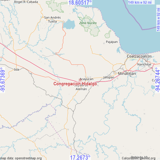
| Map corner | latitude | longitude |
|---|---|---|
| Upper-left | 18.60517°, | -95.67369° |
| Center: | 17.9375°, | -94.97056° |
| Lower-right: | 17.2673°, | -94.26744° |
| Map W x H: | 148.8×148.8 km | = 92.5×92.5mi |
| max Lat: | 32.7° ⇑79.3% North |
| Congregación Hidalgo: | 17.9375° |
| min Lat: | ⇓20.7% South 14.53588° |
| min Long | Congregación H | max Long |
| -117.105° | -94.97056° | -86.73105° |
| W 84.7%⇐ | ⇒15.3% E |
Elevation
Elevation of Congregación Hidalgo is 82 m = 269 ft, and this is 1171.7 m = 3844 ft below average elevation for this country.
| Max E: |
3497 m = 11473 ft | 81% |
| Avg. | 1253.7 m = 4113 ft | |
| Congregación Hidalgo | 82 m = 269 ft | |
Min E: |
-1 m = -3 ft | 19% |
See also: Mexico elevation on elevation.city.
Geographical zone
Congregación Hidalgo is located in North Torrid zone (between Equator and Tropic of Cancer). Distance of this Northern Tropic circle is 611.5 km =380 mi to North.| Distance of | km | miles | from Congregación Hidalgo |
|---|---|---|---|
| North Pole | 8012.6 | 4978.8 | to North |
| Arctic Circle | 5406.7 | 3359.6 | to North |
| Tropic Cancer | 611.5 | 380 | to North |
| Equator | 1994.5 | 1239.3 | to South |


Nearby cities:
15 places around Congregación Hidalgo: (largest is in red/bold)
• Acayucan
6.2 km =3.9 mi,  77°
77°
• Cirilo Vázquez Lagunes
7.8 km =4.8 mi,  45°
45°
• Colonia Lealtad
7.7 km =4.8 mi,  68°
68°
• Cruz del Milagro
5.4 km =3.4 mi,  232°
232°
• Dehesa
2.9 km =1.8 mi,  279°
279°
• El Hato
6.6 km =4.1 mi,  8°
8°
• Fraccionamiento Santa Cruz
8.9 km =5.5 mi,  64°
64°
• La Cerquilla
9.5 km =5.9 mi,  249°
249°
• Nuevo Poblado el Hato
0.2 km =0.1 mi,  117°
117°
• Oluta
7.9 km =4.9 mi,  96°
96°
• Sayula de Alemán
6.3 km =3.9 mi,  169°
169°
• Soconusco
9.9 km =6.2 mi, 73°
• Tecuanapa
9.6 km =6 mi,  39°
39°
• Tenejapa
11.8 km =7.3 mi,  114°
114°
• Vista Hermosa
9.7 km =6 mi,  260°
260°
Sources, notices
• [Note1] Compared only with cities in Mexico existing in our database
• [Src1] Map data: © OpenStreetMap contributors (CC-BY-SA)
• [Src2] Other city data from geonames.org with taken over terms of usage.
• [Src3] Geographical zone / Annual Mean Temperature by Robert A. Rohde @ Wikipedia
