Nuevo Poblado el Hato geodata
Nuevo Poblado el Hato (Veracruz) is a populated place; located in Mexico in America/Mexico_City (GMT-6) time zone. With population of 560 people, there are 15231 cities with bigger population in this country. Compared to other cities in Mexico, 79.3% of cities are located further ↑North; 84.7% of cities are located further ←West and 81% of cities have higher elevation than Nuevo Poblado el Hato. Note1


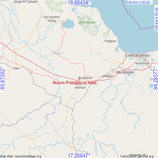
Nuevo Poblado el Hato GPS coordinates[2]
17° 56' 12.012" North, 94° 58' 8.004" West
| Map corner | latitude | longitude |
|---|---|---|
| Upper-left | 18.60434°, | -95.67202° |
| Center: | 17.93667°, | -94.96889° |
| Lower-right: | 17.26647°, | -94.26577° |
| Map W x H: | 148.8×148.8 km | = 92.5×92.5mi |
| max Lat: | 32.7° ⇑79.3% North |
| Nuevo Poblado el Hato: | 17.93667° |
| min Lat: | ⇓20.7% South 14.53588° |
| min Long | Nuevo Poblado e | max Long |
| -117.105° | -94.96889° | -86.73105° |
| W 84.7%⇐ | ⇒15.3% E |
Elevation
Elevation of Nuevo Poblado el Hato is 82 m = 269 ft, and this is 1171.7 m = 3844 ft below average elevation for this country.
| Max E: |
3497 m = 11473 ft | 81% |
| Avg. | 1253.7 m = 4113 ft | |
| Nuevo Poblado el Hato | 82 m = 269 ft | |
Min E: |
-1 m = -3 ft | 19% |
See also: Mexico elevation on elevation.city.
Geographical zone
Nuevo Poblado el Hato is located in North Torrid zone (between Equator and Tropic of Cancer). Distance of this Northern Tropic circle is 611.5 km =380 mi to North.| Distance of | km | miles | from Nuevo Poblado el Hato |
|---|---|---|---|
| North Pole | 8012.7 | 4978.9 | to North |
| Arctic Circle | 5406.8 | 3359.6 | to North |
| Tropic Cancer | 611.5 | 380 | to North |
| Equator | 1994.4 | 1239.3 | to South |


Nearby cities:
15 places around Nuevo Poblado el Hato: (largest is in red/bold)
• Acayucan
6 km =3.7 mi,  75°
75°
• Cirilo Vázquez Lagunes
7.8 km =4.8 mi,  43°
43°
• Colonia Lealtad
7.6 km =4.7 mi,  67°
67°
• Congregación Hidalgo
0.2 km =0.1 mi,  297°
297°
• Cruz del Milagro
5.4 km =3.4 mi,  234°
234°
• Dehesa
3.1 km =1.9 mi,  280°
280°
• El Hato
6.7 km =4.2 mi,  6°
6°
• Fraccionamiento Santa Cruz
8.7 km =5.4 mi,  63°
63°
• La Cerquilla
9.7 km =6 mi,  250°
250°
• Oluta
7.7 km =4.8 mi,  95°
95°
• Sayula de Alemán
6.2 km =3.9 mi,  171°
171°
• Soconusco
9.8 km =6.1 mi, 72°
• Tecuanapa
9.5 km =5.9 mi, 37°
• Tenejapa
11.6 km =7.2 mi,  114°
114°
• Vista Hermosa
9.8 km =6.1 mi,  261°
261°
Sources, notices
• [Note1] Compared only with cities in Mexico existing in our database
• [Src1] Map data: © OpenStreetMap contributors (CC-BY-SA)
• [Src2] Other city data from geonames.org with taken over terms of usage.
• [Src3] Geographical zone / Annual Mean Temperature by Robert A. Rohde @ Wikipedia
