Estero del Ídolo geodata
Estero del Ídolo (Veracruz) is a populated place; located in Mexico in America/Mexico_City (GMT-6) time zone. With population of 3,833 people, there are 2384 cities with bigger population in this country. Compared to other cities in Mexico, 74.7% of cities are located further ↓South; 67.8% of cities are located further ←West and 89.4% of cities have higher elevation than Estero del Ídolo. Note1


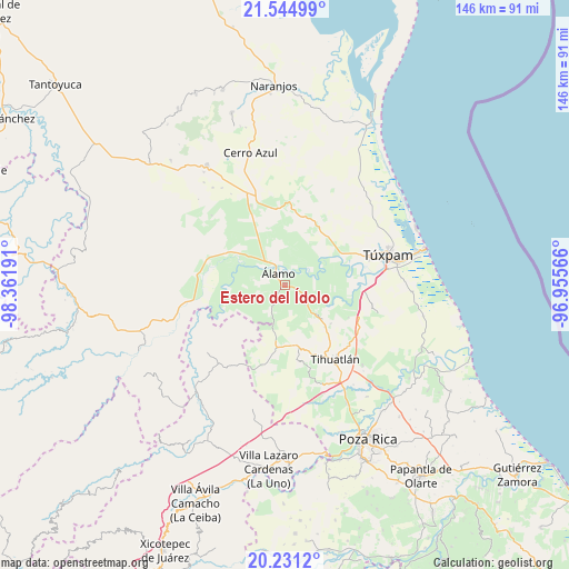
Estero del Ídolo GPS coordinates[2]
20° 53' 22.308" North, 97° 39' 31.608" West
| Map corner | latitude | longitude |
|---|---|---|
| Upper-left | 21.54499°, | -98.36191° |
| Center: | 20.88953°, | -97.65878° |
| Lower-right: | 20.2312°, | -96.95566° |
| Map W x H: | 146.1×146.1 km | = 90.8×90.8mi |
| max Lat: | 32.7° ⇑25.3% North |
| Estero del Ídolo: | 20.88953° |
| min Lat: | ⇓74.7% South 14.53588° |
| min Long | Estero del Ído | max Long |
| -117.105° | -97.65878° | -86.73105° |
| W 67.8%⇐ | ⇒32.2% E |
Elevation
Elevation of Estero del Ídolo is 26 m = 85 ft, and this is 1227.7 m = 4028 ft below average elevation for this country.
| Max E: |
3497 m = 11473 ft | 89.4% |
| Avg. | 1253.7 m = 4113 ft | |
| Estero del Ídolo | 26 m = 85 ft | |
Min E: |
-1 m = -3 ft | 10.6% |
See also: Mexico elevation on elevation.city.
Geographical zone
Estero del Ídolo is located in North Torrid zone (between Equator and Tropic of Cancer). Distance of this Northern Tropic circle is 283.2 km =176 mi to North.| Distance of | km | miles | from Estero del Ídolo |
|---|---|---|---|
| North Pole | 7684.4 | 4774.9 | to North |
| Arctic Circle | 5078.5 | 3155.6 | to North |
| Tropic Cancer | 283.2 | 176 | to North |
| Equator | 2322.7 | 1443.3 | to South |


Nearby cities:
15 places around Estero del Ídolo: (largest is in red/bold)
• Agua Nacida
5.7 km =3.5 mi,  298°
298°
• Aquiles Serdán
6.2 km =3.9 mi,  207°
207°
• Cerro Dulce
6.9 km =4.3 mi,  136°
136°
• Chapopote Núñez
5.3 km =3.3 mi,  332°
332°
• Citlaltépetl
6 km =3.7 mi,  118°
118°
• Hidalgo Amajac
3.5 km =2.2 mi,  60°
60°
• Jardín Viejo
2.6 km =1.6 mi,  15°
15°
• Kilómetro Treinta y Tres (Paso Real)
6.9 km =4.3 mi,  77°
77°
• La Concepción
3.6 km =2.2 mi,  217°
217°
• La Providencia
6.4 km =4 mi, 213°
• La Reforma
2.7 km =1.7 mi,  173°
173°
• La Tortuga
4.3 km =2.7 mi,  305°
305°
• La Unión
0.7 km =0.4 mi,  293°
293°
• Loma Bonita
5.8 km =3.6 mi,  340°
340°
• Álamo
3 km =1.9 mi,  324°
324°
Sources, notices
• [Note1] Compared only with cities in Mexico existing in our database
• [Src1] Map data: © OpenStreetMap contributors (CC-BY-SA)
• [Src2] Other city data from geonames.org with taken over terms of usage.
• [Src3] Geographical zone / Annual Mean Temperature by Robert A. Rohde @ Wikipedia
