Totolapa geodata
Totolapa (Veracruz) is a populated place; located in Mexico in America/Mexico_City (GMT-6) time zone. With population of 8,060 people, there are 1176 cities with bigger population in this country. Compared to other cities in Mexico, 69.1% of cities are located further ↓South; 69.8% of cities are located further ←West and 84.1% of cities have higher elevation than Totolapa. Note1


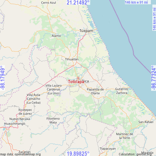
Totolapa GPS coordinates[2]
20° 33' 28.8" North, 97° 28' 34.896" West
| Map corner | latitude | longitude |
|---|---|---|
| Upper-left | 21.21492°, | -98.17949° |
| Center: | 20.558°, | -97.47636° |
| Lower-right: | 19.89825°, | -96.77324° |
| Map W x H: | 146.4×146.4 km | = 91×91mi |
| max Lat: | 32.7° ⇑30.9% North |
| Totolapa: | 20.558° |
| min Lat: | ⇓69.1% South 14.53588° |
| min Long | Totolapa | max Long |
| -117.105° | -97.47636° | -86.73105° |
| W 69.8%⇐ | ⇒30.2% E |
Elevation
Elevation of Totolapa is 51 m = 167 ft, and this is 1202.7 m = 3946 ft below average elevation for this country.
| Max E: |
3497 m = 11473 ft | 84.1% |
| Avg. | 1253.7 m = 4113 ft | |
| Totolapa | 51 m = 167 ft | |
Min E: |
-1 m = -3 ft | 15.9% |
See also: Mexico elevation on elevation.city.
Geographical zone
Totolapa is located in North Torrid zone (between Equator and Tropic of Cancer). Distance of this Northern Tropic circle is 320.1 km =198.9 mi to North.| Distance of | km | miles | from Totolapa |
|---|---|---|---|
| North Pole | 7721.2 | 4797.7 | to North |
| Arctic Circle | 5115.3 | 3178.5 | to North |
| Tropic Cancer | 320.1 | 198.9 | to North |
| Equator | 2285.8 | 1420.3 | to South |


Nearby cities:
15 places around Totolapa: (largest is in red/bold)
• Arroyo del Maíz Uno
6.8 km =4.2 mi,  110°
110°
• Colonia las Arboledas
6.6 km =4.1 mi,  55°
55°
• Emiliano Zapata
5.3 km =3.3 mi,  258°
258°
• Fraccionamiento la Florida
5.9 km =3.7 mi, 57°
• Huizotate
6.3 km =3.9 mi,  301°
301°
• La Isla (Kilómetro 10)
6.1 km =3.8 mi,  334°
334°
• La Isla Km 10
5.9 km =3.7 mi,  336°
336°
• Miguel Hidalgo
2.7 km =1.7 mi, 258°
• Plan de Ayala
1.1 km =0.7 mi,  152°
152°
• Poza Rica de Hidalgo
3.3 km =2.1 mi, 147°
• Rancho Nuevo
3.5 km =2.2 mi,  26°
26°
• Ricardo Flores Magón
5.2 km =3.2 mi,  201°
201°
• San Miguel Mecatepec
3.4 km =2.1 mi, 199°
• Villa de las Flores
4.9 km =3 mi,  65°
65°
• Úrsulo Galván
6.3 km =3.9 mi,  38°
38°
Sources, notices
• [Note1] Compared only with cities in Mexico existing in our database
• [Src1] Map data: © OpenStreetMap contributors (CC-BY-SA)
• [Src2] Other city data from geonames.org with taken over terms of usage.
• [Src3] Geographical zone / Annual Mean Temperature by Robert A. Rohde @ Wikipedia
