Totomoxtle geodata
Totomoxtle (Veracruz) is a populated place; located in Mexico in America/Mexico_City (GMT-6) time zone. With population of 638 people, there are 13580 cities with bigger population in this country. Compared to other cities in Mexico, 67% of cities are located further ↓South; 71.9% of cities are located further ←West and 81.5% of cities have higher elevation than Totomoxtle. Note1


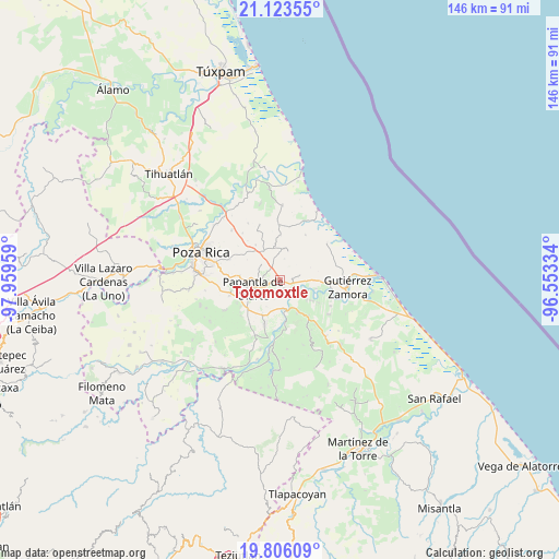
Totomoxtle GPS coordinates[2]
20° 27' 58.428" North, 97° 15' 23.256" West
| Map corner | latitude | longitude |
|---|---|---|
| Upper-left | 21.12355°, | -97.95959° |
| Center: | 20.46623°, | -97.25646° |
| Lower-right: | 19.80609°, | -96.55334° |
| Map W x H: | 146.5×146.5 km | = 91×91mi |
| max Lat: | 32.7° ⇑33% North |
| Totomoxtle: | 20.46623° |
| min Lat: | ⇓67% South 14.53588° |
| min Long | Totomoxtle | max Long |
| -117.105° | -97.25646° | -86.73105° |
| W 71.9%⇐ | ⇒28.1% E |
Elevation
Elevation of Totomoxtle is 76 m = 249 ft, and this is 1177.7 m = 3864 ft below average elevation for this country.
| Max E: |
3497 m = 11473 ft | 81.5% |
| Avg. | 1253.7 m = 4113 ft | |
| Totomoxtle | 76 m = 249 ft | |
Min E: |
-1 m = -3 ft | 18.5% |
See also: Mexico elevation on elevation.city.
Geographical zone
Totomoxtle is located in North Torrid zone (between Equator and Tropic of Cancer). Distance of this Northern Tropic circle is 330.3 km =205.2 mi to North.| Distance of | km | miles | from Totomoxtle |
|---|---|---|---|
| North Pole | 7731.4 | 4804.1 | to North |
| Arctic Circle | 5125.5 | 3184.8 | to North |
| Tropic Cancer | 330.3 | 205.2 | to North |
| Equator | 2275.6 | 1414 | to South |


Nearby cities:
15 places around Totomoxtle: (largest is in red/bold)
• Carrillo Puerto
9.6 km =6 mi,  123°
123°
• Cerro del Carbón
7.7 km =4.8 mi,  205°
205°
• El Cedro
5.3 km =3.3 mi,  75°
75°
• El Chote
11.6 km =7.2 mi,  231°
231°
• El Palmar
2.3 km =1.4 mi,  149°
149°
• El Porvenir Número Uno
9.6 km =6 mi, 207°
• El Remolino
9.7 km =6 mi, 151°
• Hermenegildo Galeana
10.6 km =6.6 mi,  90°
90°
• La Concha
4.1 km =2.5 mi,  291°
291°
• La Guásima
8.2 km =5.1 mi,  5°
5°
• Lomas de Arena
11.8 km =7.3 mi, 122°
• Papantla de Olarte
7.5 km =4.7 mi,  252°
252°
• Polutla
6.9 km =4.3 mi,  357°
357°
• San Pablo
6.8 km =4.2 mi, 93°
• Santa Águeda
11.2 km =7 mi,  326°
326°
Sources, notices
• [Note1] Compared only with cities in Mexico existing in our database
• [Src1] Map data: © OpenStreetMap contributors (CC-BY-SA)
• [Src2] Other city data from geonames.org with taken over terms of usage.
• [Src3] Geographical zone / Annual Mean Temperature by Robert A. Rohde @ Wikipedia
