El Panorama geodata
El Panorama (Veracruz) is a populated place; located in Mexico in America/Mexico_City (GMT-6) time zone. With population of 1,244 people, there are 6974 cities with bigger population in this country. Compared to other cities in Mexico, 63.3% of cities are located further ↓South; 68% of cities are located further ←West and 76.8% of cities have higher elevation than El Panorama. Note1


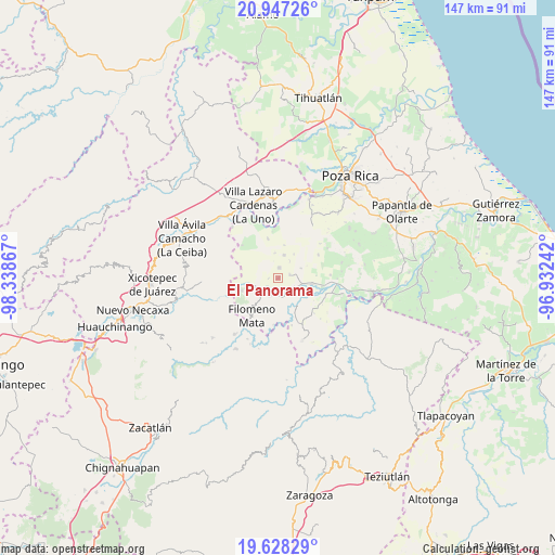
El Panorama GPS coordinates[2]
20° 17' 21.048" North, 97° 38' 7.944" West
| Map corner | latitude | longitude |
|---|---|---|
| Upper-left | 20.94726°, | -98.33867° |
| Center: | 20.28918°, | -97.63554° |
| Lower-right: | 19.62829°, | -96.93242° |
| Map W x H: | 146.7×146.7 km | = 91.2×91.2mi |
| max Lat: | 32.7° ⇑36.7% North |
| El Panorama: | 20.28918° |
| min Lat: | ⇓63.3% South 14.53588° |
| min Long | El Panorama | max Long |
| -117.105° | -97.63554° | -86.73105° |
| W 68%⇐ | ⇒32% E |
Elevation
Elevation of El Panorama is 159 m = 522 ft, and this is 1094.7 m = 3592 ft below average elevation for this country.
| Max E: |
3497 m = 11473 ft | 76.8% |
| Avg. | 1253.7 m = 4113 ft | |
| El Panorama | 159 m = 522 ft | |
Min E: |
-1 m = -3 ft | 23.2% |
See also: Mexico elevation on elevation.city.
Geographical zone
El Panorama is located in North Torrid zone (between Equator and Tropic of Cancer). Distance of this Northern Tropic circle is 350 km =217.5 mi to North.| Distance of | km | miles | from El Panorama |
|---|---|---|---|
| North Pole | 7751.1 | 4816.3 | to North |
| Arctic Circle | 5145.2 | 3197.1 | to North |
| Tropic Cancer | 350 | 217.5 | to North |
| Equator | 2255.9 | 1401.8 | to South |


Nearby cities:
15 places around El Panorama: (largest is in red/bold)
• Calalco
8.3 km =5.2 mi,  175°
175°
• Cerro Grande
7.4 km =4.6 mi,  220°
220°
• Coyutla
5.2 km =3.2 mi,  206°
206°
• Cruz Verde
2.6 km =1.6 mi,  267°
267°
• El Arenal
5.1 km =3.2 mi,  117°
117°
• El Pacífico
7 km =4.3 mi,  103°
103°
• La Colonia Guadalupe
6.2 km =3.9 mi,  12°
12°
• La Noria
7.9 km =4.9 mi, 101°
• Las Lomas
3.8 km =2.4 mi,  146°
146°
• Lázaro Cárdenas (Santana)
8.4 km =5.2 mi, 148°
• Macedonio Alonso
6.1 km =3.8 mi,  254°
254°
• Progreso de Zaragoza
8.1 km =5 mi,  258°
258°
• San Leoncio Jamaya
6.2 km =3.9 mi,  65°
65°
• San Marcos
7.6 km =4.7 mi,  33°
33°
• Tulapilla
2.6 km =1.6 mi, 8°
Sources, notices
• [Note1] Compared only with cities in Mexico existing in our database
• [Src1] Map data: © OpenStreetMap contributors (CC-BY-SA)
• [Src2] Other city data from geonames.org with taken over terms of usage.
• [Src3] Geographical zone / Annual Mean Temperature by Robert A. Rohde @ Wikipedia
