Progreso de Zaragoza geodata
Progreso de Zaragoza (Veracruz) is a seat of a second-order administrative division; located in Mexico in America/Mexico_City (GMT-6) time zone. With population of 2,474 people, there are 3576 cities with bigger population in this country. Compared to other cities in Mexico, 63% of cities are located further ↓South; 67.1% of cities are located further ←West and 76.1% of cities have higher elevation than Progreso de Zaragoza. Note1
Current local time in Progreso de Zaragoza:
08:30 AM, WednesdayDifference from your time zone: hours


Progreso de Zaragoza GPS coordinates[2]
20° 16' 29.64" North, 97° 42' 41.868" West
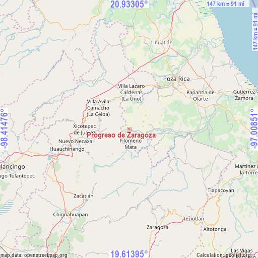
| Map corner | latitude | longitude |
|---|---|---|
| Upper-left | 20.93305°, | -98.41476° |
| Center: | 20.2749°, | -97.71163° |
| Lower-right: | 19.61395°, | -97.00851° |
| Map W x H: | 146.7×146.7 km | = 91.2×91.2mi |
| max Lat: | 32.7° ⇑37% North |
| Progreso de Zaragoza: | 20.2749° |
| min Lat: | ⇓63% South 14.53588° |
| min Long | Progreso de Zar | max Long |
| -117.105° | -97.71163° | -86.73105° |
| W 67.1%⇐ | ⇒32.9% E |
Elevation
Elevation of Progreso de Zaragoza is 182 m = 597 ft, and this is 1071.7 m = 3516 ft below average elevation for this country.
| Max E: |
3497 m = 11473 ft | 76.1% |
| Avg. | 1253.7 m = 4113 ft | |
| Progreso de Zaragoza | 182 m = 597 ft | |
Min E: |
-1 m = -3 ft | 23.9% |
See also: Mexico elevation on elevation.city.
Geographical zone
Progreso de Zaragoza is located in North Torrid zone (between Equator and Tropic of Cancer). Distance of this Northern Tropic circle is 351.6 km =218.5 mi to North.| Distance of | km | miles | from Progreso de Zaragoza |
|---|---|---|---|
| North Pole | 7752.7 | 4817.3 | to North |
| Arctic Circle | 5146.8 | 3198.1 | to North |
| Tropic Cancer | 351.6 | 218.5 | to North |
| Equator | 2254.4 | 1400.8 | to South |


Nearby cities:
15 places around Progreso de Zaragoza: (largest is in red/bold)
• Cerro Grande
5.1 km =3.2 mi,  142°
142°
• Cerro Verde
8.4 km =5.2 mi,  329°
329°
• Coahuitlán
2.4 km =1.5 mi,  229°
229°
• Coyutla
6.4 km =4 mi,  118°
118°
• Cruz Verde
5.6 km =3.5 mi,  74°
74°
• El Crucero
6.4 km =4 mi,  170°
170°
• El Panorama
8.1 km =5 mi,  78°
78°
• Filomeno Mata
8.4 km =5.2 mi, 174°
• La Cruz
9.4 km =5.8 mi,  152°
152°
• Las Lomas
10.2 km =6.3 mi,  98°
98°
• Macedonio Alonso
2.1 km =1.3 mi,  92°
92°
• Mecatlán
7.8 km =4.8 mi,  156°
156°
• San Pedro Tlaolantongo
10.6 km =6.6 mi,  242°
242°
• Tenangulto
9.4 km =5.8 mi,  307°
307°
• Tulapilla
9.3 km =5.8 mi,  63°
63°
Sources, notices
• [Note1] Compared only with cities in Mexico existing in our database
• [Src1] Map data: © OpenStreetMap contributors (CC-BY-SA)
• [Src2] Other city data from geonames.org with taken over terms of usage.
• [Src3] Geographical zone / Annual Mean Temperature by Robert A. Rohde @ Wikipedia
