Guadalupe Victoria geodata
Guadalupe Victoria (Veracruz) is a populated place; located in Mexico in America/Mexico_City (GMT-6) time zone. With population of 750 people, there are 11679 cities with bigger population in this country. Compared to other cities in Mexico, 65.2% of cities are located further ↓South; 68.8% of cities are located further ←West and 77.8% of cities have higher elevation than Guadalupe Victoria. Note1


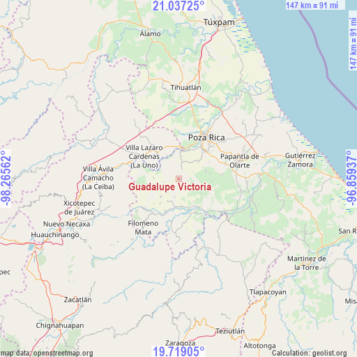
Guadalupe Victoria GPS coordinates[2]
20° 22' 46.416" North, 97° 33' 44.964" West
| Map corner | latitude | longitude |
|---|---|---|
| Upper-left | 21.03725°, | -98.26562° |
| Center: | 20.37956°, | -97.56249° |
| Lower-right: | 19.71905°, | -96.85937° |
| Map W x H: | 146.6×146.6 km | = 91.1×91.1mi |
| max Lat: | 32.7° ⇑34.8% North |
| Guadalupe Victoria: | 20.37956° |
| min Lat: | ⇓65.2% South 14.53588° |
| min Long | Guadalupe Victo | max Long |
| -117.105° | -97.56249° | -86.73105° |
| W 68.8%⇐ | ⇒31.2% E |
Elevation
Elevation of Guadalupe Victoria is 134 m = 440 ft, and this is 1119.7 m = 3674 ft below average elevation for this country.
| Max E: |
3497 m = 11473 ft | 77.8% |
| Avg. | 1253.7 m = 4113 ft | |
| Guadalupe Victoria | 134 m = 440 ft | |
Min E: |
-1 m = -3 ft | 22.2% |
See also: Mexico elevation on elevation.city.
Geographical zone
Guadalupe Victoria is located in North Torrid zone (between Equator and Tropic of Cancer). Distance of this Northern Tropic circle is 339.9 km =211.2 mi to North.| Distance of | km | miles | from Guadalupe Victoria |
|---|---|---|---|
| North Pole | 7741.1 | 4810.1 | to North |
| Arctic Circle | 5135.2 | 3190.9 | to North |
| Tropic Cancer | 339.9 | 211.2 | to North |
| Equator | 2266 | 1408 | to South |


Nearby cities:
15 places around Guadalupe Victoria: (largest is in red/bold)
• Buenavista
11.1 km =6.9 mi,  146°
146°
• Calichar Palma Sola
7 km =4.3 mi,  9°
9°
• Chicualoque
10.3 km =6.4 mi,  271°
271°
• Francisco Sarabia
5.7 km =3.5 mi,  111°
111°
• La Colonia Guadalupe
7.4 km =4.6 mi,  237°
237°
• La Noria
11.6 km =7.2 mi,  179°
179°
• Manuel María Contreras
11.1 km =6.9 mi,  48°
48°
• Melchor Ocampo
4.8 km =3 mi,  143°
143°
• Plan del Palmar
11.6 km =7.2 mi,  74°
74°
• Poza Larga Zapotal
10.8 km =6.7 mi,  123°
123°
• San Fernando Coapechapa
6.2 km =3.9 mi,  257°
257°
• San Leoncio Jamaya
7.7 km =4.8 mi,  194°
194°
• San Marcos
5.1 km =3.2 mi,  223°
223°
• Santa María
10.7 km =6.6 mi,  1°
1°
• Tulapilla
10.4 km =6.5 mi, 223°
Sources, notices
• [Note1] Compared only with cities in Mexico existing in our database
• [Src1] Map data: © OpenStreetMap contributors (CC-BY-SA)
• [Src2] Other city data from geonames.org with taken over terms of usage.
• [Src3] Geographical zone / Annual Mean Temperature by Robert A. Rohde @ Wikipedia
