Chicualoque geodata
Chicualoque (Veracruz) is a populated place; located in Mexico in America/Mexico_City (GMT-6) time zone. With population of 1,085 people, there are 8027 cities with bigger population in this country. Compared to other cities in Mexico, 65.2% of cities are located further ↓South; 67.8% of cities are located further ←West and 77.4% of cities have higher elevation than Chicualoque. Note1


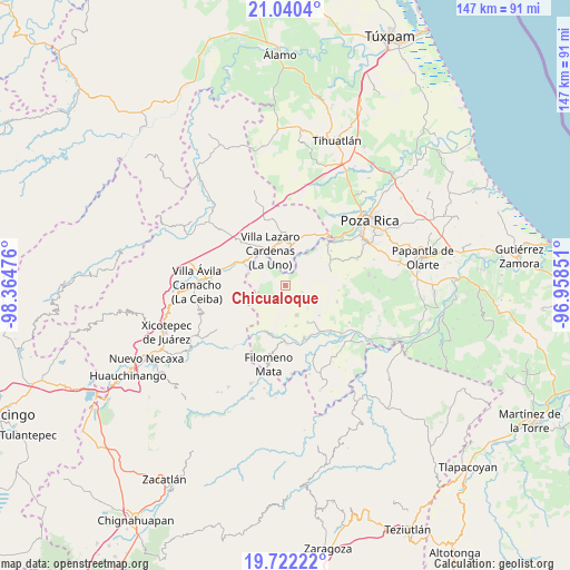
Chicualoque GPS coordinates[2]
20° 22' 57.792" North, 97° 39' 41.868" West
| Map corner | latitude | longitude |
|---|---|---|
| Upper-left | 21.0404°, | -98.36476° |
| Center: | 20.38272°, | -97.66163° |
| Lower-right: | 19.72222°, | -96.95851° |
| Map W x H: | 146.6×146.6 km | = 91.1×91.1mi |
| max Lat: | 32.7° ⇑34.8% North |
| Chicualoque: | 20.38272° |
| min Lat: | ⇓65.2% South 14.53588° |
| min Long | Chicualoque | max Long |
| -117.105° | -97.66163° | -86.73105° |
| W 67.8%⇐ | ⇒32.2% E |
Elevation
Elevation of Chicualoque is 143 m = 469 ft, and this is 1110.7 m = 3644 ft below average elevation for this country.
| Max E: |
3497 m = 11473 ft | 77.4% |
| Avg. | 1253.7 m = 4113 ft | |
| Chicualoque | 143 m = 469 ft | |
Min E: |
-1 m = -3 ft | 22.6% |
See also: Mexico elevation on elevation.city.
Geographical zone
Chicualoque is located in North Torrid zone (between Equator and Tropic of Cancer). Distance of this Northern Tropic circle is 339.6 km =211 mi to North.| Distance of | km | miles | from Chicualoque |
|---|---|---|---|
| North Pole | 7740.7 | 4809.8 | to North |
| Arctic Circle | 5134.8 | 3190.6 | to North |
| Tropic Cancer | 339.6 | 211 | to North |
| Equator | 2266.3 | 1408.2 | to South |


Nearby cities:
15 places around Chicualoque: (largest is in red/bold)
• Cerro Verde
10.5 km =6.5 mi,  243°
243°
• Coronel Tito Hernández
11.3 km =7 mi,  316°
316°
• Cruz Verde
10.5 km =6.5 mi,  179°
179°
• El Panorama
10.8 km =6.7 mi,  165°
165°
• Estrella Roja
6.6 km =4.1 mi,  342°
342°
• Guadalupe Victoria
10.3 km =6.4 mi,  91°
91°
• La Colonia Guadalupe
6 km =3.7 mi,  136°
136°
• La Libertad
8.3 km =5.2 mi, 337°
• La Palma
10 km =6.2 mi,  288°
288°
• Paso de Coyutla
7.3 km =4.5 mi,  325°
325°
• San Bartolo del Escobal
5.4 km =3.4 mi,  358°
358°
• San Fernando Coapechapa
4.6 km =2.9 mi,  111°
111°
• San Marcos
8 km =5 mi,  120°
120°
• Tulapilla
8.4 km =5.2 mi,  158°
158°
• Villa Lázaro Cárdenas
9.7 km =6 mi, 335°
Sources, notices
• [Note1] Compared only with cities in Mexico existing in our database
• [Src1] Map data: © OpenStreetMap contributors (CC-BY-SA)
• [Src2] Other city data from geonames.org with taken over terms of usage.
• [Src3] Geographical zone / Annual Mean Temperature by Robert A. Rohde @ Wikipedia
