Cruz Tetela geodata
Cruz Tetela (Veracruz) is a populated place; located in Mexico in America/Mexico_City (GMT-6) time zone. With population of 1,000 people, there are 8715 cities with bigger population in this country. Compared to other cities in Mexico, 70.3% of cities are located further ↑North; 78.1% of cities are located further ←West and 72.5% of cities have higher elevation than Cruz Tetela. Note1


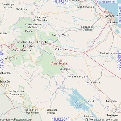
Cruz Tetela GPS coordinates[2]
18° 41' 24.648" North, 96° 43' 40.908" West
| Map corner | latitude | longitude |
|---|---|---|
| Upper-left | 19.3549°, | -97.43116° |
| Center: | 18.69018°, | -96.72803° |
| Lower-right: | 18.02284°, | -96.02491° |
| Map W x H: | 148.1×148.1 km | = 92×92mi |
| max Lat: | 32.7° ⇑70.3% North |
| Cruz Tetela: | 18.69018° |
| min Lat: | ⇓29.7% South 14.53588° |
| min Long | Cruz Tetela | max Long |
| -117.105° | -96.72803° | -86.73105° |
| W 78.1%⇐ | ⇒21.9% E |
Elevation
Elevation of Cruz Tetela is 313 m = 1027 ft, and this is 940.7 m = 3086 ft below average elevation for this country.
| Max E: |
3497 m = 11473 ft | 72.5% |
| Avg. | 1253.7 m = 4113 ft | |
| Cruz Tetela | 313 m = 1027 ft | |
Min E: |
-1 m = -3 ft | 27.5% |
See also: Mexico elevation on elevation.city.
Geographical zone
Cruz Tetela is located in North Torrid zone (between Equator and Tropic of Cancer). Distance of this Northern Tropic circle is 527.8 km =328 mi to North.| Distance of | km | miles | from Cruz Tetela |
|---|---|---|---|
| North Pole | 7928.9 | 4926.8 | to North |
| Arctic Circle | 5323 | 3307.6 | to North |
| Tropic Cancer | 527.8 | 328 | to North |
| Equator | 2078.2 | 1291.3 | to South |


Nearby cities:
15 places around Cruz Tetela: (largest is in red/bold)
• Balsa Larga
4.9 km =3 mi,  308°
308°
• El Jobo
6.6 km =4.1 mi, 309°
• Emiliano Zapata
2.5 km =1.6 mi,  329°
329°
• La Providencia
8.3 km =5.2 mi, 327°
• Mata Naranjo
9.8 km =6.1 mi,  9°
9°
• Mata Tenatito (Casco Hacienda)
7.7 km =4.8 mi,  62°
62°
• Motzorongo
5.3 km =3.3 mi,  181°
181°
• Omealca
8.8 km =5.5 mi,  316°
316°
• Paso Amapa
9.3 km =5.8 mi,  118°
118°
• Paso del Rosario
5.3 km =3.3 mi,  19°
19°
• Pocitos
6.3 km =3.9 mi,  281°
281°
• Presidio (Plan de Libres)
4.7 km =2.9 mi,  256°
256°
• Río Moreno
8.7 km =5.4 mi,  99°
99°
• Toluquilla Buena Vista
6.5 km =4 mi,  345°
345°
• Xonotla
10.1 km =6.3 mi,  285°
285°
Sources, notices
• [Note1] Compared only with cities in Mexico existing in our database
• [Src1] Map data: © OpenStreetMap contributors (CC-BY-SA)
• [Src2] Other city data from geonames.org with taken over terms of usage.
• [Src3] Geographical zone / Annual Mean Temperature by Robert A. Rohde @ Wikipedia
