Mata Naranjo geodata
Mata Naranjo (Veracruz) is a populated place; located in Mexico in America/Mexico_City (GMT-6) time zone. With population of 1,069 people, there are 8160 cities with bigger population in this country. Compared to other cities in Mexico, 69.1% of cities are located further ↑North; 78.3% of cities are located further ←West and 71.8% of cities have higher elevation than Mata Naranjo. Note1


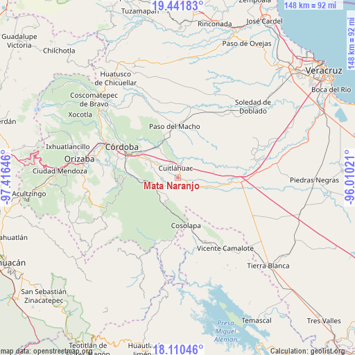
Mata Naranjo GPS coordinates[2]
18° 46' 38.856" North, 96° 42' 47.988" West
| Map corner | latitude | longitude |
|---|---|---|
| Upper-left | 19.44183°, | -97.41646° |
| Center: | 18.77746°, | -96.71333° |
| Lower-right: | 18.11046°, | -96.01021° |
| Map W x H: | 148×148 km | = 92×92mi |
| max Lat: | 32.7° ⇑69.1% North |
| Mata Naranjo: | 18.77746° |
| min Lat: | ⇓30.9% South 14.53588° |
| min Long | Mata Naranjo | max Long |
| -117.105° | -96.71333° | -86.73105° |
| W 78.3%⇐ | ⇒21.7% E |
Elevation
Elevation of Mata Naranjo is 336 m = 1102 ft, and this is 917.7 m = 3011 ft below average elevation for this country.
| Max E: |
3497 m = 11473 ft | 71.8% |
| Avg. | 1253.7 m = 4113 ft | |
| Mata Naranjo | 336 m = 1102 ft | |
Min E: |
-1 m = -3 ft | 28.2% |
See also: Mexico elevation on elevation.city.
Geographical zone
Mata Naranjo is located in North Torrid zone (between Equator and Tropic of Cancer). Distance of this Northern Tropic circle is 518.1 km =321.9 mi to North.| Distance of | km | miles | from Mata Naranjo |
|---|---|---|---|
| North Pole | 7919.2 | 4920.8 | to North |
| Arctic Circle | 5313.3 | 3301.5 | to North |
| Tropic Cancer | 518.1 | 321.9 | to North |
| Equator | 2087.9 | 1297.4 | to South |


Nearby cities:
15 places around Mata Naranjo: (largest is in red/bold)
• Arroyo Azul
5.9 km =3.7 mi,  30°
30°
• Cuitláhuac
4.2 km =2.6 mi,  346°
346°
• División del Norte (Santa Rosa)
6.1 km =3.8 mi, 345°
• El Maguey
6.6 km =4.1 mi,  340°
340°
• El Palmar
5.8 km =3.6 mi,  60°
60°
• El Tamarindo
4.5 km =2.8 mi,  324°
324°
• Emiliano Zapata
8 km =5 mi,  200°
200°
• La Providencia
6.6 km =4.1 mi,  245°
245°
• Loma Angosta
4 km =2.5 mi,  80°
80°
• Los Mangos
6.9 km =4.3 mi,  310°
310°
• Palmillas
7.4 km =4.6 mi,  304°
304°
• Paso del Rosario
4.8 km =3 mi,  177°
177°
• San Francisco (Mata Clara)
5.4 km =3.4 mi, 319°
• San José de Abajo
6.7 km =4.2 mi,  268°
268°
• Toluquilla Buena Vista
4.7 km =2.9 mi,  222°
222°
Sources, notices
• [Note1] Compared only with cities in Mexico existing in our database
• [Src1] Map data: © OpenStreetMap contributors (CC-BY-SA)
• [Src2] Other city data from geonames.org with taken over terms of usage.
• [Src3] Geographical zone / Annual Mean Temperature by Robert A. Rohde @ Wikipedia
