El Potrero geodata
El Potrero (Veracruz) is a populated place; located in Mexico in America/Mexico_City (GMT-6) time zone. With population of 1,269 people, there are 6826 cities with bigger population in this country. Compared to other cities in Mexico, 70.5% of cities are located further ↑North; 71.9% of cities are located further ←West and 77.4% of cities have lower elevation than El Potrero. Note1


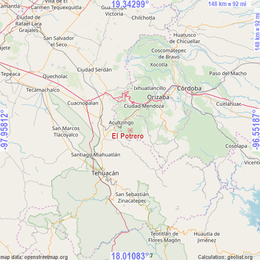
El Potrero GPS coordinates[2]
18° 40' 41.592" North, 97° 15' 17.964" West
| Map corner | latitude | longitude |
|---|---|---|
| Upper-left | 19.34299°, | -97.95812° |
| Center: | 18.67822°, | -97.25499° |
| Lower-right: | 18.01083°, | -96.55187° |
| Map W x H: | 148.1×148.1 km | = 92×92mi |
| max Lat: | 32.7° ⇑70.5% North |
| El Potrero: | 18.67822° |
| min Lat: | ⇓29.5% South 14.53588° |
| min Long | El Potrero | max Long |
| -117.105° | -97.25499° | -86.73105° |
| W 71.9%⇐ | ⇒28.1% E |
Elevation
Elevation of El Potrero is 2075 m = 6808 ft, and this is 821.3 m = 2695 ft above average elevation for this country.
| Max E: |
3497 m = 11473 ft | 22.6% |
| El Potrero | 2075 m 6808 ft | |
| Avg. | 1253.7 m = 4113 ft | |
Min E: |
-1 m = -3 ft | 77.4% |
See also: Mexico elevation on elevation.city.
Geographical zone
El Potrero is located in North Torrid zone (between Equator and Tropic of Cancer). Distance of this Northern Tropic circle is 529.1 km =328.8 mi to North.| Distance of | km | miles | from El Potrero |
|---|---|---|---|
| North Pole | 7930.2 | 4927.6 | to North |
| Arctic Circle | 5324.4 | 3308.4 | to North |
| Tropic Cancer | 529.1 | 328.8 | to North |
| Equator | 2076.8 | 1290.5 | to South |


Nearby cities:
15 places around El Potrero: (largest is in red/bold)
• Acatla
8.8 km =5.5 mi,  25°
25°
• Acultzinapa
7.1 km =4.4 mi,  82°
82°
• Acultzingo
6.8 km =4.2 mi,  311°
311°
• Atexcalco
8.6 km =5.3 mi,  62°
62°
• Coatepec de Abajo (Rincón Lobo)
3.2 km =2 mi,  355°
355°
• Coxolitla de Abajo
7.6 km =4.7 mi,  9°
9°
• Nicolás Bravo
8.8 km =5.5 mi,  219°
219°
• Próspero Pineda
7.4 km =4.6 mi,  2°
2°
• Puente de Guadalupe
7.2 km =4.5 mi, 4°
• San Bernardino Lagunas
8.4 km =5.2 mi,  187°
187°
• Sierra de Agua
8.1 km =5 mi, 9°
• Soledad Atzompa
9.1 km =5.7 mi,  54°
54°
• Tepaxapa
7.9 km =4.9 mi,  103°
103°
• Tetlatzinga
7.7 km =4.8 mi, 76°
• Xiquila
7.3 km =4.5 mi, 61°
Sources, notices
• [Note1] Compared only with cities in Mexico existing in our database
• [Src1] Map data: © OpenStreetMap contributors (CC-BY-SA)
• [Src2] Other city data from geonames.org with taken over terms of usage.
• [Src3] Geographical zone / Annual Mean Temperature by Robert A. Rohde @ Wikipedia
