Acultzingo geodata
Acultzingo (Veracruz) is a seat of a second-order administrative division; located in Mexico in America/Mexico_City (GMT-6) time zone. With population of 7,040 people, there are 1318 cities with bigger population in this country. Compared to other cities in Mexico, 70% of cities are located further ↑North; 71.5% of cities are located further ←West and 57.3% of cities have lower elevation than Acultzingo. Note1


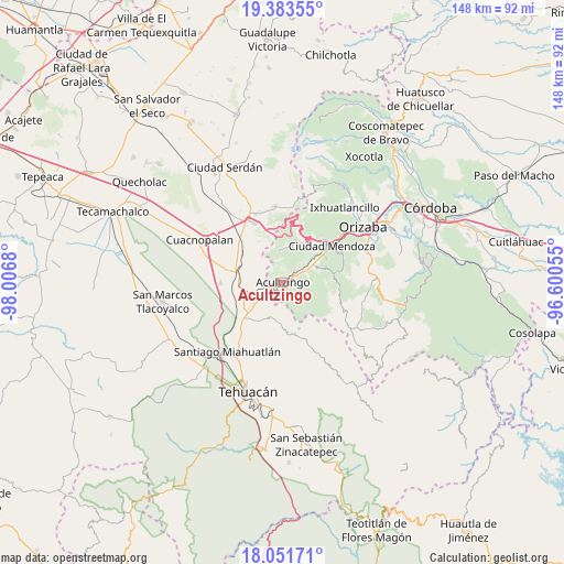
Acultzingo GPS coordinates[2]
18° 43' 8.184" North, 97° 18' 13.212" West
| Map corner | latitude | longitude |
|---|---|---|
| Upper-left | 19.38355°, | -98.0068° |
| Center: | 18.71894°, | -97.30367° |
| Lower-right: | 18.05171°, | -96.60055° |
| Map W x H: | 148.1×148.1 km | = 92×92mi |
| max Lat: | 32.7° ⇑70% North |
| Acultzingo: | 18.71894° |
| min Lat: | ⇓30% South 14.53588° |
| min Long | Acultzingo | max Long |
| -117.105° | -97.30367° | -86.73105° |
| W 71.5%⇐ | ⇒28.5% E |
Elevation
Elevation of Acultzingo is 1670 m = 5479 ft, and this is 416.3 m = 1366 ft above average elevation for this country.
| Max E: |
3497 m = 11473 ft | 42.7% |
| Acultzingo | 1670 m 5479 ft | |
| Avg. | 1253.7 m = 4113 ft | |
Min E: |
-1 m = -3 ft | 57.3% |
See also: Mexico elevation on elevation.city.
Geographical zone
Acultzingo is located in North Torrid zone (between Equator and Tropic of Cancer). Distance of this Northern Tropic circle is 524.6 km =326 mi to North.| Distance of | km | miles | from Acultzingo |
|---|---|---|---|
| North Pole | 7925.7 | 4924.8 | to North |
| Arctic Circle | 5319.8 | 3305.6 | to North |
| Tropic Cancer | 524.6 | 326 | to North |
| Equator | 2081.4 | 1293.3 | to South |


Nearby cities:
15 places around Acultzingo: (largest is in red/bold)
• Acatla
9.6 km =6 mi,  69°
69°
• Aquila
8.5 km =5.3 mi,  356°
356°
• Boca Nopal
6.6 km =4.1 mi,  309°
309°
• Buena Vista
8.1 km =5 mi,  290°
290°
• Coatepec de Abajo (Rincón Lobo)
5.1 km =3.2 mi,  105°
105°
• Coxolitla de Abajo
7 km =4.3 mi,  64°
64°
• El Potrero
6.8 km =4.2 mi,  131°
131°
• Guadalupe Fresnal
7.8 km =4.8 mi,  317°
317°
• Huiloapan
3.7 km =2.3 mi,  338°
338°
• Próspero Pineda
6.2 km =3.9 mi, 61°
• Puente Colorado
6.2 km =3.9 mi,  254°
254°
• Puente de Guadalupe
6.2 km =3.9 mi, 65°
• Sierra de Agua
7.4 km =4.6 mi, 61°
• Tecamalucan
9.5 km =5.9 mi, 60°
• Temaxcalapa
8.1 km =5 mi,  303°
303°
Sources, notices
• [Note1] Compared only with cities in Mexico existing in our database
• [Src1] Map data: © OpenStreetMap contributors (CC-BY-SA)
• [Src2] Other city data from geonames.org with taken over terms of usage.
• [Src3] Geographical zone / Annual Mean Temperature by Robert A. Rohde @ Wikipedia
