San Ángel geodata
San Ángel (Veracruz) is a populated place; located in Mexico in America/Mexico_City (GMT-6) time zone. With population of 882 people, there are 9904 cities with bigger population in this country. Compared to other cities in Mexico, 77.3% of cities are located further ↑North; 84.2% of cities are located further ←West and 82.9% of cities have higher elevation than San Ángel. Note1


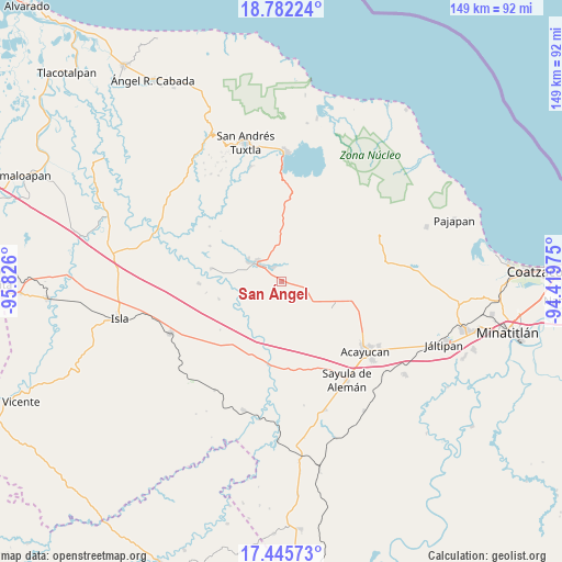
San Ángel GPS coordinates[2]
18° 6' 54.936" North, 95° 7' 22.332" West
| Map corner | latitude | longitude |
|---|---|---|
| Upper-left | 18.78224°, | -95.826° |
| Center: | 18.11526°, | -95.12287° |
| Lower-right: | 17.44573°, | -94.41975° |
| Map W x H: | 148.6×148.6 km | = 92.3×92.3mi |
| max Lat: | 32.7° ⇑77.3% North |
| San Ángel: | 18.11526° |
| min Lat: | ⇓22.7% South 14.53588° |
| min Long | San Ángel | max Long |
| -117.105° | -95.12287° | -86.73105° |
| W 84.2%⇐ | ⇒15.8% E |
Elevation
Elevation of San Ángel is 61 m = 200 ft, and this is 1192.7 m = 3913 ft below average elevation for this country.
| Max E: |
3497 m = 11473 ft | 82.9% |
| Avg. | 1253.7 m = 4113 ft | |
| San Ángel | 61 m = 200 ft | |
Min E: |
-1 m = -3 ft | 17.1% |
See also: Mexico elevation on elevation.city.
Geographical zone
San Ángel is located in North Torrid zone (between Equator and Tropic of Cancer). Distance of this Northern Tropic circle is 591.7 km =367.7 mi to North.| Distance of | km | miles | from San Ángel |
|---|---|---|---|
| North Pole | 7992.8 | 4966.5 | to North |
| Arctic Circle | 5386.9 | 3347.3 | to North |
| Tropic Cancer | 591.7 | 367.7 | to North |
| Equator | 2014.2 | 1251.6 | to South |


Nearby cities:
15 places around San Ángel: (largest is in red/bold)
• Colonia Hermosa
7.9 km =4.9 mi,  81°
81°
• Corral Nuevo
0.8 km =0.5 mi,  95°
95°
• El Sauzal
12.9 km =8 mi,  305°
305°
• Esperanza Malota
13.5 km =8.4 mi,  144°
144°
• Hueyapan de Ocampo
4.3 km =2.7 mi,  320°
320°
• Juan Díaz Covarrubias
8.4 km =5.2 mi, 306°
• La Gloria
10.8 km =6.7 mi, 305°
• Loma de los Ingleses
6.2 km =3.9 mi,  297°
297°
• Los Mangos
14.3 km =8.9 mi,  0°
0°
• Nacaxtle
8.3 km =5.2 mi,  57°
57°
• Quiamoloapan
14.7 km =9.1 mi,  113°
113°
• Sabaneta
12.8 km =8 mi,  20°
20°
• Santa Catalina
10.5 km =6.5 mi, 300°
• Santa Rosa Loma Larga
13.4 km =8.3 mi, 16°
• Tierra Nueva
14.8 km =9.2 mi,  45°
45°
Sources, notices
• [Note1] Compared only with cities in Mexico existing in our database
• [Src1] Map data: © OpenStreetMap contributors (CC-BY-SA)
• [Src2] Other city data from geonames.org with taken over terms of usage.
• [Src3] Geographical zone / Annual Mean Temperature by Robert A. Rohde @ Wikipedia
