La Chinantla geodata
La Chinantla (Veracruz) is a seat of a second-order administrative division; located in Mexico in America/Mexico_City (GMT-6) time zone. In our database, there are 16903 cities with bigger population. Compared to other cities in Mexico, 85.5% of cities are located further ↑North; 85.5% of cities are located further ←West and 78.9% of cities have higher elevation than La Chinantla. Note1


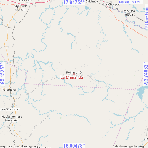
La Chinantla GPS coordinates[2]
17° 16' 38.604" North, 94° 26' 57.984" West
| Map corner | latitude | longitude |
|---|---|---|
| Upper-left | 17.94755°, | -95.15257° |
| Center: | 17.27739°, | -94.44944° |
| Lower-right: | 16.60478°, | -93.74632° |
| Map W x H: | 149.3×149.3 km | = 92.8×92.8mi |
| max Lat: | 32.7° ⇑85.5% North |
| La Chinantla: | 17.27739° |
| min Lat: | ⇓14.5% South 14.53588° |
| min Long | La Chinantla | max Long |
| -117.105° | -94.44944° | -86.73105° |
| W 85.5%⇐ | ⇒14.5% E |
Elevation
Elevation of La Chinantla is 113 m = 371 ft, and this is 1140.7 m = 3742 ft below average elevation for this country.
| Max E: |
3497 m = 11473 ft | 78.9% |
| Avg. | 1253.7 m = 4113 ft | |
| La Chinantla | 113 m = 371 ft | |
Min E: |
-1 m = -3 ft | 21.1% |
See also: Mexico elevation on elevation.city.
Geographical zone
La Chinantla is located in North Torrid zone (between Equator and Tropic of Cancer). Distance of this Northern Tropic circle is 684.9 km =425.6 mi to North.| Distance of | km | miles | from La Chinantla |
|---|---|---|---|
| North Pole | 8086 | 5024.4 | to North |
| Arctic Circle | 5480.1 | 3405.2 | to North |
| Tropic Cancer | 684.9 | 425.6 | to North |
| Equator | 1921.1 | 1193.7 | to South |


Nearby cities:
15 places around La Chinantla: (largest is in red/bold)
• Cahuapan (Anexo Niños Héroes)
22.4 km =13.9 mi,  330°
330°
• Fernando López Arias
34.5 km =21.4 mi,  29°
29°
• Helio García Alfaro
17.2 km =10.7 mi,  96°
96°
• Hermanos Cedillo
17.4 km =10.8 mi,  260°
260°
• Jorge L. Tamayo (Poblado Dos)
21.7 km =13.5 mi, 260°
• La Breña
25.5 km =15.8 mi,  14°
14°
• La Horqueta (Poblado Doce)
27.3 km =17 mi,  105°
105°
• La Laguna
5.6 km =3.5 mi, 262°
• Las Carolinas
5.9 km =3.7 mi, 13°
• Niños Héroes
18.3 km =11.4 mi,  343°
343°
• Nuevo Cantón
9.7 km =6 mi,  302°
302°
• Paso del Moral
16.5 km =10.3 mi,  253°
253°
• Plan de Arroyo
17.6 km =10.9 mi, 258°
• Poblado 10
0.3 km =0.2 mi,  265°
265°
• Poblado Cinco
10.8 km =6.7 mi, 268°
Sources, notices
• [Note1] Compared only with cities in Mexico existing in our database
• [Src1] Map data: © OpenStreetMap contributors (CC-BY-SA)
• [Src2] Other city data from geonames.org with taken over terms of usage.
• [Src3] Geographical zone / Annual Mean Temperature by Robert A. Rohde @ Wikipedia
