Hermanos Cedillo geodata
Hermanos Cedillo (Veracruz) is a populated place; located in Mexico in America/Mexico_City (GMT-6) time zone. With population of 1,217 people, there are 7142 cities with bigger population in this country. Compared to other cities in Mexico, 85.9% of cities are located further ↑North; 85.3% of cities are located further ←West and 81.9% of cities have higher elevation than Hermanos Cedillo. Note1


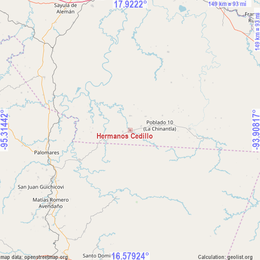
Hermanos Cedillo GPS coordinates[2]
17° 15' 6.984" North, 94° 36' 40.644" West
| Map corner | latitude | longitude |
|---|---|---|
| Upper-left | 17.9222°, | -95.31442° |
| Center: | 17.25194°, | -94.61129° |
| Lower-right: | 16.57924°, | -93.90817° |
| Map W x H: | 149.3×149.3 km | = 92.8×92.8mi |
| max Lat: | 32.7° ⇑85.9% North |
| Hermanos Cedillo: | 17.25194° |
| min Lat: | ⇓14.1% South 14.53588° |
| min Long | Hermanos Cedill | max Long |
| -117.105° | -94.61129° | -86.73105° |
| W 85.3%⇐ | ⇒14.7% E |
Elevation
Elevation of Hermanos Cedillo is 71 m = 233 ft, and this is 1182.7 m = 3880 ft below average elevation for this country.
| Max E: |
3497 m = 11473 ft | 81.9% |
| Avg. | 1253.7 m = 4113 ft | |
| Hermanos Cedillo | 71 m = 233 ft | |
Min E: |
-1 m = -3 ft | 18.1% |
See also: Mexico elevation on elevation.city.
Geographical zone
Hermanos Cedillo is located in North Torrid zone (between Equator and Tropic of Cancer). Distance of this Northern Tropic circle is 687.7 km =427.3 mi to North.| Distance of | km | miles | from Hermanos Cedillo |
|---|---|---|---|
| North Pole | 8088.8 | 5026.1 | to North |
| Arctic Circle | 5482.9 | 3406.9 | to North |
| Tropic Cancer | 687.7 | 427.3 | to North |
| Equator | 1918.2 | 1191.9 | to South |


Nearby cities:
15 places around Hermanos Cedillo: (largest is in red/bold)
• Cahuapan (Anexo Niños Héroes)
23.2 km =14.4 mi,  15°
15°
• Jorge L. Tamayo (Poblado Dos)
4.3 km =2.7 mi,  260°
260°
• La Chinantla
17.4 km =10.8 mi,  80°
80°
• La Esmeralda
21.1 km =13.1 mi,  242°
242°
• La Laguna
11.8 km =7.3 mi, 79°
• Las Carolinas
20.5 km =12.7 mi,  65°
65°
• Modelo Dos Ríos
22.9 km =14.2 mi,  314°
314°
• Niños Héroes
23.6 km =14.7 mi,  30°
30°
• Nuevo Cantón
12 km =7.5 mi,  48°
48°
• Paso del Moral
2.2 km =1.4 mi,  143°
143°
• Plan de Arroyo
0.7 km =0.4 mi,  180°
180°
• Poblado 10
17.2 km =10.7 mi, 80°
• Poblado Cinco
6.8 km =4.2 mi, 68°
• Veinticuatro
22.3 km =13.9 mi,  267°
267°
• Vicente Guerrero
29.5 km =18.3 mi,  337°
337°
Sources, notices
• [Note1] Compared only with cities in Mexico existing in our database
• [Src1] Map data: © OpenStreetMap contributors (CC-BY-SA)
• [Src2] Other city data from geonames.org with taken over terms of usage.
• [Src3] Geographical zone / Annual Mean Temperature by Robert A. Rohde @ Wikipedia
