La Breña geodata
La Breña (Veracruz) is a populated place; located in Mexico in America/Mexico_City (GMT-6) time zone. With population of 871 people, there are 10028 cities with bigger population in this country. Compared to other cities in Mexico, 83.2% of cities are located further ↑North; 85.6% of cities are located further ←West and 84.6% of cities have higher elevation than La Breña. Note1


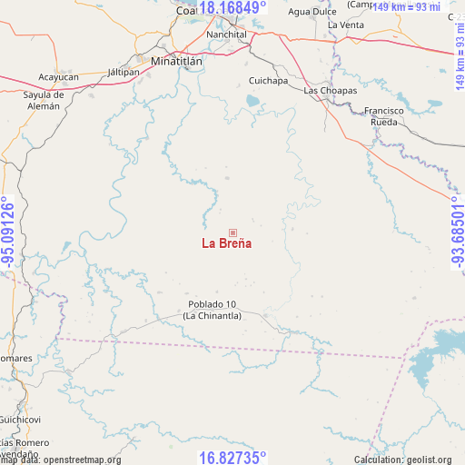
La Breña GPS coordinates[2]
17° 29' 56.976" North, 94° 23' 17.268" West
| Map corner | latitude | longitude |
|---|---|---|
| Upper-left | 18.16849°, | -95.09126° |
| Center: | 17.49916°, | -94.38813° |
| Lower-right: | 16.82735°, | -93.68501° |
| Map W x H: | 149.1×149.1 km | = 92.6×92.6mi |
| max Lat: | 32.7° ⇑83.2% North |
| La Breña: | 17.49916° |
| min Lat: | ⇓16.8% South 14.53588° |
| min Long | La Breña | max Long |
| -117.105° | -94.38813° | -86.73105° |
| W 85.6%⇐ | ⇒14.4% E |
Elevation
Elevation of La Breña is 47 m = 154 ft, and this is 1206.7 m = 3959 ft below average elevation for this country.
| Max E: |
3497 m = 11473 ft | 84.6% |
| Avg. | 1253.7 m = 4113 ft | |
| La Breña | 47 m = 154 ft | |
Min E: |
-1 m = -3 ft | 15.4% |
See also: Mexico elevation on elevation.city.
Geographical zone
La Breña is located in North Torrid zone (between Equator and Tropic of Cancer). Distance of this Northern Tropic circle is 660.2 km =410.2 mi to North.| Distance of | km | miles | from La Breña |
|---|---|---|---|
| North Pole | 8061.3 | 5009.1 | to North |
| Arctic Circle | 5455.4 | 3389.8 | to North |
| Tropic Cancer | 660.2 | 410.2 | to North |
| Equator | 1945.7 | 1209 | to South |


Nearby cities:
15 places around La Breña: (largest is in red/bold)
• Adalberto Tejeda
18.9 km =11.7 mi,  61°
61°
• Cahuapan (Anexo Niños Héroes)
18.1 km =11.2 mi,  253°
253°
• El Macayal
32.9 km =20.4 mi,  300°
300°
• Fernando López Arias
11.6 km =7.2 mi, 62°
• Gustavo Díaz Ordaz
21.6 km =13.4 mi,  16°
16°
• Helio García Alfaro
28.7 km =17.8 mi,  158°
158°
• La Chinantla
25.5 km =15.8 mi,  194°
194°
• La Laguna
28.1 km =17.5 mi,  205°
205°
• Las Carolinas
19.6 km =12.2 mi,  195°
195°
• Niños Héroes
13.7 km =8.5 mi,  238°
238°
• Nueva Esperanza
23.8 km =14.8 mi,  90°
90°
• Nuevo Atoyac
17.7 km =11 mi,  354°
354°
• Nuevo Cantón
24.4 km =15.2 mi,  217°
217°
• Poblado 10
25.6 km =15.9 mi, 195°
• Poblado Cinco
30.4 km =18.9 mi, 214°
Sources, notices
• [Note1] Compared only with cities in Mexico existing in our database
• [Src1] Map data: © OpenStreetMap contributors (CC-BY-SA)
• [Src2] Other city data from geonames.org with taken over terms of usage.
• [Src3] Geographical zone / Annual Mean Temperature by Robert A. Rohde @ Wikipedia
