San Miguel Enyege geodata
San Miguel Enyege (State of Mexico) is a populated place; located in Mexico in America/Mexico_City (GMT-6) time zone. With population of 2,410 people, there are 3659 cities with bigger population in this country. Compared to other cities in Mexico, 52.6% of cities are located further ↑North; 62.2% of cities are located further →East and 93.8% of cities have lower elevation than San Miguel Enyege. Note1


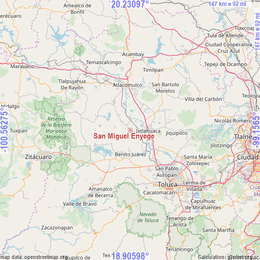
San Miguel Enyege GPS coordinates[2]
19° 34' 11.424" North, 99° 51' 34.632" West
| Map corner | latitude | longitude |
|---|---|---|
| Upper-left | 20.23097°, | -100.56275° |
| Center: | 19.56984°, | -99.85962° |
| Lower-right: | 18.90598°, | -99.1565° |
| Map W x H: | 147.3×147.3 km | = 91.5×91.5mi |
| max Lat: | 32.7° ⇑52.6% North |
| San Miguel Enyege: | 19.56984° |
| min Lat: | ⇓47.4% South 14.53588° |
| min Long | San Miguel Enye | max Long |
| -117.105° | -99.85962° | -86.73105° |
| W 37.8%⇐ | ⇒62.2% E |
Elevation
Elevation of San Miguel Enyege is 2562 m = 8406 ft, and this is 1308.3 m = 4292 ft above average elevation for this country.
| Max E: |
3497 m = 11473 ft | 6.2% |
| San Miguel Enyege | 2562 m 8406 ft | |
| Avg. | 1253.7 m = 4113 ft | |
Min E: |
-1 m = -3 ft | 93.8% |
See also: Mexico elevation on elevation.city.
Geographical zone
San Miguel Enyege is located in North Torrid zone (between Equator and Tropic of Cancer). Distance of this Northern Tropic circle is 430 km =267.2 mi to North.| Distance of | km | miles | from San Miguel Enyege |
|---|---|---|---|
| North Pole | 7831.1 | 4866 | to North |
| Arctic Circle | 5225.2 | 3246.8 | to North |
| Tropic Cancer | 430 | 267.2 | to North |
| Equator | 2176 | 1352.1 | to South |


Nearby cities:
15 places around San Miguel Enyege: (largest is in red/bold)
• Dolores Enyege
1.2 km =0.7 mi,  92°
92°
• El Rincón de los Perales
4.5 km =2.8 mi,  132°
132°
• Guadalupe Cachi
5 km =3.1 mi,  46°
46°
• La Concepción Enyege
2 km =1.2 mi,  106°
106°
• La Guadalupana
5.5 km =3.4 mi,  251°
251°
• Palos Amarillos (Palos Amarillos Yebuciví)
6.9 km =4.3 mi,  240°
240°
• San Andrés del Pedregal
1.6 km =1 mi,  322°
322°
• San Ignacio del Pedregal
4.2 km =2.6 mi,  10°
10°
• San Isidro Boxipe
4.8 km =3 mi, 316°
• San Juan de las Manzanas
3.1 km =1.9 mi, 133°
• San Mateo Ixtlahuaca
7.4 km =4.6 mi,  56°
56°
• San Pedro Los Baños
7.3 km =4.5 mi,  32°
32°
• San Pedro el Alto
2.7 km =1.7 mi,  306°
306°
• Santa Ana Ixtlahuaca (Santa Ana Ixtlahuacingo)
3.4 km =2.1 mi,  299°
299°
• Santa Ana la Ladera
3.1 km =1.9 mi,  339°
339°
Sources, notices
• [Note1] Compared only with cities in Mexico existing in our database
• [Src1] Map data: © OpenStreetMap contributors (CC-BY-SA)
• [Src2] Other city data from geonames.org with taken over terms of usage.
• [Src3] Geographical zone / Annual Mean Temperature by Robert A. Rohde @ Wikipedia
