Santa Cruz Mextepec geodata
Santa Cruz Mextepec (State of Mexico) is a populated place; located in Mexico in America/Mexico_City (GMT-6) time zone. With population of 1,836 people, there are 4733 cities with bigger population in this country. Compared to other cities in Mexico, 50.6% of cities are located further ↑North; 63.3% of cities are located further →East and 94.1% of cities have lower elevation than Santa Cruz Mextepec. Note1


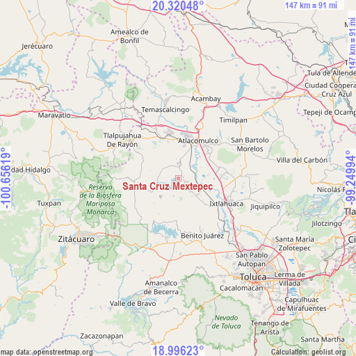
Santa Cruz Mextepec GPS coordinates[2]
19° 39' 34.992" North, 99° 57' 11.016" West
| Map corner | latitude | longitude |
|---|---|---|
| Upper-left | 20.32048°, | -100.65619° |
| Center: | 19.65972°, | -99.95306° |
| Lower-right: | 18.99623°, | -99.24994° |
| Map W x H: | 147.2×147.2 km | = 91.5×91.5mi |
| max Lat: | 32.7° ⇑50.6% North |
| Santa Cruz Mextepec: | 19.65972° |
| min Lat: | ⇓49.4% South 14.53588° |
| min Long | Santa Cruz Mext | max Long |
| -117.105° | -99.95306° | -86.73105° |
| W 36.7%⇐ | ⇒63.3% E |
Elevation
Elevation of Santa Cruz Mextepec is 2577 m = 8455 ft, and this is 1323.3 m = 4342 ft above average elevation for this country.
| Max E: |
3497 m = 11473 ft | 5.9% |
| Santa Cruz Mextepec | 2577 m 8455 ft | |
| Avg. | 1253.7 m = 4113 ft | |
Min E: |
-1 m = -3 ft | 94.1% |
See also: Mexico elevation on elevation.city.
Geographical zone
Santa Cruz Mextepec is located in North Torrid zone (between Equator and Tropic of Cancer). Distance of this Northern Tropic circle is 420 km =261 mi to North.| Distance of | km | miles | from Santa Cruz Mextepec |
|---|---|---|---|
| North Pole | 7821.1 | 4859.8 | to North |
| Arctic Circle | 5215.2 | 3240.6 | to North |
| Tropic Cancer | 420 | 261 | to North |
| Equator | 2186 | 1358.3 | to South |


Nearby cities:
15 places around Santa Cruz Mextepec: (largest is in red/bold)
• Calvario Buenavista
4.9 km =3 mi,  355°
355°
• Dolores Hidalgo
2.8 km =1.7 mi,  100°
100°
• Ejido de San Juan Jalpa
5.7 km =3.5 mi,  50°
50°
• El Carmen Ocotepec
3.8 km =2.4 mi,  324°
324°
• Emilio Portes Gil
4.2 km =2.6 mi,  114°
114°
• Estutempan
3.5 km =2.2 mi,  255°
255°
• La Cabecera Concepción
5 km =3.1 mi,  14°
14°
• Palmillas
3.8 km =2.4 mi,  4°
4°
• San Agustín Mextepec
4.1 km =2.5 mi,  137°
137°
• San Antonio Mextepec
0.7 km =0.4 mi, 136°
• San Felipe del Progreso
6.1 km =3.8 mi, 1°
• San Jerónimo Bonchete
3.2 km =2 mi,  173°
173°
• San Juan Cote Ejido
6.1 km =3.8 mi,  185°
185°
• San Juan Jalpa Centro
4.9 km =3 mi,  29°
29°
• San Lucas Ocotepec
2.9 km =1.8 mi, 316°
Sources, notices
• [Note1] Compared only with cities in Mexico existing in our database
• [Src1] Map data: © OpenStreetMap contributors (CC-BY-SA)
• [Src2] Other city data from geonames.org with taken over terms of usage.
• [Src3] Geographical zone / Annual Mean Temperature by Robert A. Rohde @ Wikipedia
