Estutempan geodata
Estutempan (State of Mexico) is a populated place; located in Mexico in America/Mexico_City (GMT-6) time zone. With population of 528 people, there are 16014 cities with bigger population in this country. Compared to other cities in Mexico, 50.9% of cities are located further ↑North; 63.8% of cities are located further →East and 96% of cities have lower elevation than Estutempan. Note1


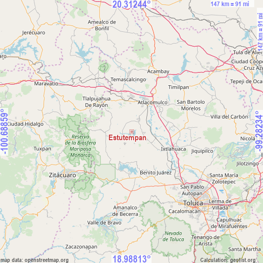
Estutempan GPS coordinates[2]
19° 39' 5.94" North, 99° 59' 7.656" West
| Map corner | latitude | longitude |
|---|---|---|
| Upper-left | 20.31244°, | -100.68859° |
| Center: | 19.65165°, | -99.98546° |
| Lower-right: | 18.98813°, | -99.28234° |
| Map W x H: | 147.2×147.3 km | = 91.5×91.5mi |
| max Lat: | 32.7° ⇑50.9% North |
| Estutempan: | 19.65165° |
| min Lat: | ⇓49.1% South 14.53588° |
| min Long | Estutempan | max Long |
| -117.105° | -99.98546° | -86.73105° |
| W 36.2%⇐ | ⇒63.8% E |
Elevation
Elevation of Estutempan is 2626 m = 8615 ft, and this is 1372.3 m = 4502 ft above average elevation for this country.
| Max E: |
3497 m = 11473 ft | 4% |
| Estutempan | 2626 m 8615 ft | |
| Avg. | 1253.7 m = 4113 ft | |
Min E: |
-1 m = -3 ft | 96% |
See also: Mexico elevation on elevation.city.
Geographical zone
Estutempan is located in North Torrid zone (between Equator and Tropic of Cancer). Distance of this Northern Tropic circle is 420.9 km =261.5 mi to North.| Distance of | km | miles | from Estutempan |
|---|---|---|---|
| North Pole | 7822 | 4860.4 | to North |
| Arctic Circle | 5216.1 | 3241.1 | to North |
| Tropic Cancer | 420.9 | 261.5 | to North |
| Equator | 2185.1 | 1357.8 | to South |


Nearby cities:
15 places around Estutempan: (largest is in red/bold)
• Barrio Santa Cruz de San Pablo Tlalchichilpa
6.4 km =4 mi,  3°
3°
• Calvario Buenavista
6.5 km =4 mi,  27°
27°
• Calvario del Carmen
3.2 km =2 mi,  235°
235°
• Dolores Hidalgo
6.2 km =3.9 mi,  86°
86°
• El Carmen Ocotepec
4.1 km =2.5 mi,  16°
16°
• Guadalupe Coté
4.5 km =2.8 mi,  179°
179°
• Palmillas
5.9 km =3.7 mi,  38°
38°
• Purísima Concepción Mayorazgo
4.8 km =3 mi,  338°
338°
• San Agustín Mextepec
6.5 km =4 mi,  108°
108°
• San Antonio Mextepec
3.9 km =2.4 mi,  84°
84°
• San Jerónimo Bonchete
4.4 km =2.7 mi,  121°
121°
• San Juan Cote Ejido
5.9 km =3.7 mi,  151°
151°
• San Lucas Ocotepec
3.3 km =2.1 mi, 25°
• San Nicolás Guadalupe
6.3 km =3.9 mi,  228°
228°
• Santa Cruz Mextepec
3.5 km =2.2 mi, 75°
Sources, notices
• [Note1] Compared only with cities in Mexico existing in our database
• [Src1] Map data: © OpenStreetMap contributors (CC-BY-SA)
• [Src2] Other city data from geonames.org with taken over terms of usage.
• [Src3] Geographical zone / Annual Mean Temperature by Robert A. Rohde @ Wikipedia
