Denjhi geodata
Denjhi (State of Mexico) is a populated place; located in Mexico in America/Mexico_City (GMT-6) time zone. With population of 1,238 people, there are 7007 cities with bigger population in this country. Compared to other cities in Mexico, 55.5% of cities are located further ↓South; 57.4% of cities are located further →East and 92.7% of cities have lower elevation than Denjhi. Note1


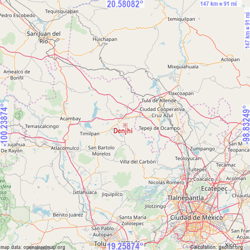
Denjhi GPS coordinates[2]
19° 55' 16.176" North, 99° 32' 8.196" West
| Map corner | latitude | longitude |
|---|---|---|
| Upper-left | 20.58082°, | -100.23874° |
| Center: | 19.92116°, | -99.53561° |
| Lower-right: | 19.25874°, | -98.83249° |
| Map W x H: | 147×147 km | = 91.3×91.3mi |
| max Lat: | 32.7° ⇑44.5% North |
| Denjhi: | 19.92116° |
| min Lat: | ⇓55.5% South 14.53588° |
| min Long | Denjhi | max Long |
| -117.105° | -99.53561° | -86.73105° |
| W 42.6%⇐ | ⇒57.4% E |
Elevation
Elevation of Denjhi is 2516 m = 8255 ft, and this is 1262.3 m = 4141 ft above average elevation for this country.
| Max E: |
3497 m = 11473 ft | 7.3% |
| Denjhi | 2516 m 8255 ft | |
| Avg. | 1253.7 m = 4113 ft | |
Min E: |
-1 m = -3 ft | 92.7% |
See also: Mexico elevation on elevation.city.
Geographical zone
Denjhi is located in North Torrid zone (between Equator and Tropic of Cancer). Distance of this Northern Tropic circle is 390.9 km =242.9 mi to North.| Distance of | km | miles | from Denjhi |
|---|---|---|---|
| North Pole | 7792 | 4841.7 | to North |
| Arctic Circle | 5186.1 | 3222.5 | to North |
| Tropic Cancer | 390.9 | 242.9 | to North |
| Equator | 2215 | 1376.3 | to South |


Nearby cities:
15 places around Denjhi: (largest is in red/bold)
• Agua Escondida
7.8 km =4.8 mi,  325°
325°
• Coscomate del Progreso
2.3 km =1.4 mi,  50°
50°
• Dexcani Bajo
4.6 km =2.9 mi, 51°
• Doxhicho
3.3 km =2.1 mi,  223°
223°
• Ejido de Coscomate del Progreso
1.9 km =1.2 mi,  319°
319°
• El Durazno de Cuauhtémoc
7.3 km =4.5 mi,  262°
262°
• El Huisache (Tercera Manzana de Dexcani Alto)
5.8 km =3.6 mi,  60°
60°
• El Magueyal
4.7 km =2.9 mi,  300°
300°
• Jilotepec de Molina Enríquez
3.4 km =2.1 mi,  4°
4°
• Las Huertas
6.1 km =3.8 mi,  339°
339°
• Las Manzanas
4.2 km =2.6 mi, 320°
• Octeyuco Dos Mil
7.2 km =4.5 mi,  310°
310°
• Santa María
7.4 km =4.6 mi,  195°
195°
• Xhitey
6.8 km =4.2 mi,  6°
6°
• Xhixhata
5.6 km =3.5 mi,  348°
348°
Sources, notices
• [Note1] Compared only with cities in Mexico existing in our database
• [Src1] Map data: © OpenStreetMap contributors (CC-BY-SA)
• [Src2] Other city data from geonames.org with taken over terms of usage.
• [Src3] Geographical zone / Annual Mean Temperature by Robert A. Rohde @ Wikipedia
