Monte de Peña geodata
Monte de Peña (State of Mexico) is a populated place; located in Mexico in America/Mexico_City (GMT-6) time zone. With population of 894 people, there are 9757 cities with bigger population in this country. Compared to other cities in Mexico, 51.2% of cities are located further ↓South; 57.6% of cities are located further →East and 99.1% of cities have lower elevation than Monte de Peña. Note1


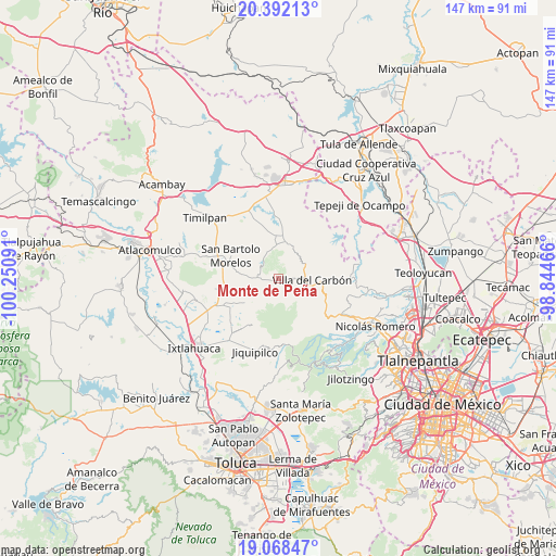
Monte de Peña GPS coordinates[2]
19° 43' 54.012" North, 99° 32' 52.008" West
| Map corner | latitude | longitude |
|---|---|---|
| Upper-left | 20.39213°, | -100.25091° |
| Center: | 19.73167°, | -99.54778° |
| Lower-right: | 19.06847°, | -98.84466° |
| Map W x H: | 147.2×147.2 km | = 91.5×91.5mi |
| max Lat: | 32.7° ⇑48.8% North |
| Monte de Peña: | 19.73167° |
| min Lat: | ⇓51.2% South 14.53588° |
| min Long | Monte de Peña | max Long |
| -117.105° | -99.54778° | -86.73105° |
| W 42.4%⇐ | ⇒57.6% E |
Elevation
Elevation of Monte de Peña is 2854 m = 9364 ft, and this is 1600.3 m = 5250 ft above average elevation for this country.
| Max E: |
3497 m = 11473 ft | 0.90000000000001% |
| Monte de Peña | 2854 m 9364 ft | |
| Avg. | 1253.7 m = 4113 ft | |
Min E: |
-1 m = -3 ft | 99.1% |
See also: Mexico elevation on elevation.city.
Geographical zone
Monte de Peña is located in North Torrid zone (between Equator and Tropic of Cancer). Distance of this Northern Tropic circle is 412 km =256 mi to North.| Distance of | km | miles | from Monte de Peña |
|---|---|---|---|
| North Pole | 7813.1 | 4854.8 | to North |
| Arctic Circle | 5207.2 | 3235.6 | to North |
| Tropic Cancer | 412 | 256 | to North |
| Equator | 2194 | 1363.3 | to South |


Nearby cities:
15 places around Monte de Peña: (largest is in red/bold)
• Cadenqui
9.1 km =5.7 mi,  324°
324°
• Chapa de Mota
9.4 km =5.8 mi,  13°
13°
• El Cerrito
7.2 km =4.5 mi,  136°
136°
• La Capilla
3.1 km =1.9 mi,  89°
89°
• La Cruz (San Simón la Cruz)
4.3 km =2.7 mi,  265°
265°
• La Esperanza
6.3 km =3.9 mi,  147°
147°
• La Ladera
9.2 km =5.7 mi,  348°
348°
• Llano de Zacapexco
7.2 km =4.5 mi,  115°
115°
• Los Arana
5.4 km =3.4 mi, 117°
• Los Barbechos
8.7 km =5.4 mi,  129°
129°
• San Francisco de las Tablas
4.3 km =2.7 mi,  27°
27°
• San Sebastián Buenos Aires
5.9 km =3.7 mi, 265°
• Santa Clara de Juárez
6.3 km =3.9 mi,  257°
257°
• Tenjay
8.5 km =5.3 mi,  356°
356°
• Villa del Carbón
8.8 km =5.5 mi, 92°
Sources, notices
• [Note1] Compared only with cities in Mexico existing in our database
• [Src1] Map data: © OpenStreetMap contributors (CC-BY-SA)
• [Src2] Other city data from geonames.org with taken over terms of usage.
• [Src3] Geographical zone / Annual Mean Temperature by Robert A. Rohde @ Wikipedia
