La Cruz (San Simón la Cruz) geodata
La Cruz (San Simón la Cruz) (State of Mexico) is a populated place; located in Mexico in America/Mexico_City (GMT-6) time zone. With population of 667 people, there are 13011 cities with bigger population in this country. Compared to other cities in Mexico, 51.1% of cities are located further ↓South; 58.3% of cities are located further →East and 98.4% of cities have lower elevation than La Cruz (San Simón la Cruz). Note1
Current local time in La Cruz (San Simón la Cruz):
07:23 AM, MondayDifference from your time zone: hours


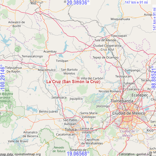
La Cruz (San Simón la Cruz) GPS coordinates[2]
19° 43' 44.004" North, 99° 35' 17.988" West
| Map corner | latitude | longitude |
|---|---|---|
| Upper-left | 20.38936°, | -100.29146° |
| Center: | 19.72889°, | -99.58833° |
| Lower-right: | 19.06568°, | -98.88521° |
| Map W x H: | 147.2×147.2 km | = 91.5×91.5mi |
| max Lat: | 32.7° ⇑48.9% North |
| La Cruz (San Simón la Cruz): | 19.72889° |
| min Lat: | ⇓51.1% South 14.53588° |
| min Long | La Cruz (San Si | max Long |
| -117.105° | -99.58833° | -86.73105° |
| W 41.7%⇐ | ⇒58.3% E |
Elevation
Elevation of La Cruz (San Simón la Cruz) is 2782 m = 9127 ft, and this is 1528.3 m = 5014 ft above average elevation for this country.
| Max E: |
3497 m = 11473 ft | 1.6% |
| La Cruz (San Simón la Cruz) | 2782 m 9127 ft | |
| Avg. | 1253.7 m = 4113 ft | |
Min E: |
-1 m = -3 ft | 98.4% |
See also: Mexico elevation on elevation.city.
Geographical zone
La Cruz (San Simón la Cruz) is located in North Torrid zone (between Equator and Tropic of Cancer). Distance of this Northern Tropic circle is 412.3 km =256.2 mi to North.| Distance of | km | miles | from La Cruz (San Simón la Cruz) |
|---|---|---|---|
| North Pole | 7813.4 | 4855 | to North |
| Arctic Circle | 5207.5 | 3235.8 | to North |
| Tropic Cancer | 412.3 | 256.2 | to North |
| Equator | 2193.6 | 1363 | to South |


Nearby cities:
15 places around La Cruz (San Simón la Cruz): (largest is in red/bold)
• Cadenqui
7.9 km =4.9 mi,  352°
352°
• Colonia Emiliano Zapata
8.5 km =5.3 mi,  235°
235°
• La Capilla
7.3 km =4.5 mi,  87°
87°
• La Esperanza
9.1 km =5.7 mi,  123°
123°
• Los Arana
9.3 km =5.8 mi,  103°
103°
• Monte de Peña
4.3 km =2.7 mi, 85°
• Pueblo Nuevo
6.8 km =4.2 mi,  206°
206°
• San Francisco de las Tablas
7.4 km =4.6 mi,  56°
56°
• San Gregorio Macapexco Barrio Segundo
6.1 km =3.8 mi,  314°
314°
• San José la Epifania
5.8 km =3.6 mi,  256°
256°
• San Lorenzo Malacota
9.2 km =5.7 mi,  196°
196°
• San Sebastián Buenos Aires
1.6 km =1 mi, 263°
• Santa Clara de Juárez
2.2 km =1.4 mi, 240°
• Tenjay
9.5 km =5.9 mi,  23°
23°
• Tlalpujahuilla
9.5 km =5.9 mi, 209°
Sources, notices
• [Note1] Compared only with cities in Mexico existing in our database
• [Src1] Map data: © OpenStreetMap contributors (CC-BY-SA)
• [Src2] Other city data from geonames.org with taken over terms of usage.
• [Src3] Geographical zone / Annual Mean Temperature by Robert A. Rohde @ Wikipedia
