San Isidro del Bosque geodata
San Isidro del Bosque (State of Mexico) is a populated place; located in Mexico in America/Mexico_City (GMT-6) time zone. With population of 691 people, there are 12594 cities with bigger population in this country. Compared to other cities in Mexico, 50.8% of cities are located further ↑North; 56.9% of cities are located further →East and 99% of cities have lower elevation than San Isidro del Bosque. Note1


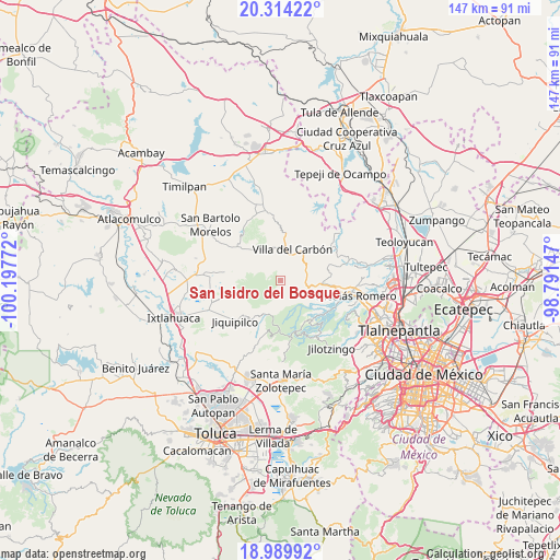
San Isidro del Bosque GPS coordinates[2]
19° 39' 12.384" North, 99° 29' 40.524" West
| Map corner | latitude | longitude |
|---|---|---|
| Upper-left | 20.31422°, | -100.19772° |
| Center: | 19.65344°, | -99.49459° |
| Lower-right: | 18.98992°, | -98.79147° |
| Map W x H: | 147.2×147.3 km | = 91.5×91.5mi |
| max Lat: | 32.7° ⇑50.8% North |
| San Isidro del Bosque: | 19.65344° |
| min Lat: | ⇓49.2% South 14.53588° |
| min Long | San Isidro del | max Long |
| -117.105° | -99.49459° | -86.73105° |
| W 43.1%⇐ | ⇒56.9% E |
Elevation
Elevation of San Isidro del Bosque is 2846 m = 9337 ft, and this is 1592.3 m = 5224 ft above average elevation for this country.
| Max E: |
3497 m = 11473 ft | 1% |
| San Isidro del Bosque | 2846 m 9337 ft | |
| Avg. | 1253.7 m = 4113 ft | |
Min E: |
-1 m = -3 ft | 99% |
See also: Mexico elevation on elevation.city.
Geographical zone
San Isidro del Bosque is located in North Torrid zone (between Equator and Tropic of Cancer). Distance of this Northern Tropic circle is 420.7 km =261.4 mi to North.| Distance of | km | miles | from San Isidro del Bosque |
|---|---|---|---|
| North Pole | 7821.8 | 4860.2 | to North |
| Arctic Circle | 5215.9 | 3241 | to North |
| Tropic Cancer | 420.7 | 261.4 | to North |
| Equator | 2185.3 | 1357.9 | to South |


Nearby cities:
15 places around San Isidro del Bosque: (largest is in red/bold)
• El Cerrito
3.5 km =2.2 mi,  351°
351°
• El Ocotal
3.9 km =2.4 mi,  41°
41°
• La Esperanza
4 km =2.5 mi,  326°
326°
• Llano de Zacapexco
5.7 km =3.5 mi,  10°
10°
• Loma Alta
6.2 km =3.9 mi,  49°
49°
• Los Arana
6.3 km =3.9 mi, 352°
• Los Barbechos
3.3 km =2.1 mi,  19°
19°
• Miranda
7.4 km =4.6 mi,  101°
101°
• Puentecillas Cahuacán
5.7 km =3.5 mi,  114°
114°
• Quinto Barrio (Ejido Cahuacán)
8.7 km =5.4 mi, 113°
• San José los Barbechos (Los Barbechos)
7.9 km =4.9 mi, 97°
• San Juan de las Tablas
7.9 km =4.9 mi,  74°
74°
• San Lucas
7.7 km =4.8 mi,  32°
32°
• Santa María Magdalena Cahuacán
8.7 km =5.4 mi, 101°
• Villa del Carbón
9 km =5.6 mi, 21°
Sources, notices
• [Note1] Compared only with cities in Mexico existing in our database
• [Src1] Map data: © OpenStreetMap contributors (CC-BY-SA)
• [Src2] Other city data from geonames.org with taken over terms of usage.
• [Src3] Geographical zone / Annual Mean Temperature by Robert A. Rohde @ Wikipedia
