El Nigromante geodata
El Nigromante (Zacatecas) is a populated place; located in Mexico in America/Mexico_City (GMT-6) time zone. With population of 2,200 people, there are 3989 cities with bigger population in this country. Compared to other cities in Mexico, 85% of cities are located further ↓South; 79.1% of cities are located further →East and 82.9% of cities have lower elevation than El Nigromante. Note1


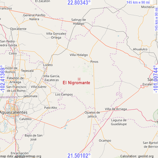
El Nigromante GPS coordinates[2]
22° 9' 13.428" North, 101° 42' 38.016" West
| Map corner | latitude | longitude |
|---|---|---|
| Upper-left | 22.80343°, | -102.41369° |
| Center: | 22.15373°, | -101.71056° |
| Lower-right: | 21.50102°, | -101.00744° |
| Map W x H: | 144.8×144.8 km | = 90×90mi |
| max Lat: | 32.7° ⇑15% North |
| El Nigromante: | 22.15373° |
| min Lat: | ⇓85% South 14.53588° |
| min Long | El Nigromante | max Long |
| -117.105° | -101.71056° | -86.73105° |
| W 20.9%⇐ | ⇒79.1% E |
Elevation
Elevation of El Nigromante is 2212 m = 7257 ft, and this is 958.3 m = 3144 ft above average elevation for this country.
| Max E: |
3497 m = 11473 ft | 17.1% |
| El Nigromante | 2212 m 7257 ft | |
| Avg. | 1253.7 m = 4113 ft | |
Min E: |
-1 m = -3 ft | 82.9% |
See also: Mexico elevation on elevation.city.
Geographical zone
El Nigromante is located in North Torrid zone (between Equator and Tropic of Cancer). Distance of this Northern Tropic circle is 142.7 km =88.7 mi to North.| Distance of | km | miles | from El Nigromante |
|---|---|---|---|
| North Pole | 7543.8 | 4687.5 | to North |
| Arctic Circle | 4937.9 | 3068.3 | to North |
| Tropic Cancer | 142.7 | 88.7 | to North |
| Equator | 2463.3 | 1530.6 | to South |


Nearby cities:
15 places around El Nigromante: (largest is in red/bold)
• El Fraile
16.1 km =10 mi,  349°
349°
• El Obraje
12.7 km =7.9 mi,  76°
76°
• Emilio Carranza
13.3 km =8.3 mi,  283°
283°
• Estancia de Guadalupe
15.1 km =9.4 mi,  21°
21°
• Granadas
16.8 km =10.4 mi,  249°
249°
• La Blanca (Chihuahua)
17.1 km =10.6 mi,  118°
118°
• La Laborcilla
5.4 km =3.4 mi,  196°
196°
• La Lobeña
15.4 km =9.6 mi,  3°
3°
• La Montesa
15.9 km =9.9 mi,  231°
231°
• La Pachona
8.7 km =5.4 mi,  340°
340°
• La Puerta de Jalisco
7.9 km =4.9 mi, 278°
• La Victoria
14.2 km =8.8 mi,  35°
35°
• Ojo de Agua de la Palma
16.8 km =10.4 mi,  185°
185°
• Pedregoso
12 km =7.5 mi, 336°
• Presa Nueva
4.3 km =2.7 mi, 124°
Sources, notices
• [Note1] Compared only with cities in Mexico existing in our database
• [Src1] Map data: © OpenStreetMap contributors (CC-BY-SA)
• [Src2] Other city data from geonames.org with taken over terms of usage.
• [Src3] Geographical zone / Annual Mean Temperature by Robert A. Rohde @ Wikipedia
