Laguna Grande geodata
Laguna Grande (Zacatecas) is a populated place; located in Mexico in America/Mexico_City (GMT-6) time zone. With population of 960 people, there are 9064 cities with bigger population in this country. Compared to other cities in Mexico, 86.5% of cities are located further ↓South; 88.3% of cities are located further →East and 79.8% of cities have lower elevation than Laguna Grande. Note1


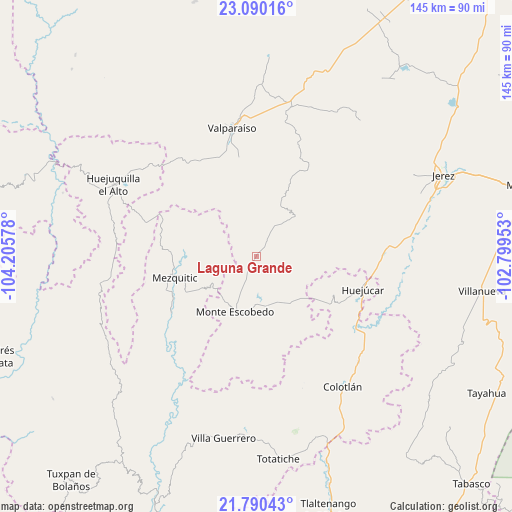
Laguna Grande GPS coordinates[2]
22° 26' 30.552" North, 103° 30' 9.54" West
| Map corner | latitude | longitude |
|---|---|---|
| Upper-left | 23.09016°, | -104.20578° |
| Center: | 22.44182°, | -103.50265° |
| Lower-right: | 21.79043°, | -102.79953° |
| Map W x H: | 144.5×144.5 km | = 89.8×89.8mi |
| max Lat: | 32.7° ⇑13.5% North |
| Laguna Grande: | 22.44182° |
| min Lat: | ⇓86.5% South 14.53588° |
| min Long | Laguna Grande | max Long |
| -117.105° | -103.50265° | -86.73105° |
| W 11.7%⇐ | ⇒88.3% E |
Elevation
Elevation of Laguna Grande is 2135 m = 7005 ft, and this is 881.3 m = 2891 ft above average elevation for this country.
| Max E: |
3497 m = 11473 ft | 20.2% |
| Laguna Grande | 2135 m 7005 ft | |
| Avg. | 1253.7 m = 4113 ft | |
Min E: |
-1 m = -3 ft | 79.8% |
See also: Mexico elevation on elevation.city.
Geographical zone
Laguna Grande is located in North Torrid zone (between Equator and Tropic of Cancer). Distance of this Northern Tropic circle is 110.6 km =68.7 mi to North.| Distance of | km | miles | from Laguna Grande |
|---|---|---|---|
| North Pole | 7511.8 | 4667.6 | to North |
| Arctic Circle | 4905.9 | 3048.4 | to North |
| Tropic Cancer | 110.6 | 68.7 | to North |
| Equator | 2495.3 | 1550.5 | to South |


Nearby cities:
15 places around Laguna Grande: (largest is in red/bold)
• Colotlán
43.9 km =27.3 mi,  146°
146°
• Huejuquilla el Alto
45.4 km =28.2 mi,  296°
296°
• Huejúcar
31.3 km =19.4 mi,  107°
107°
• Las Golondrinas [Fraccionamiento]
45.3 km =28.1 mi, 145°
• Lobatos
43.5 km =27 mi,  13°
13°
• Mezquitic
23.8 km =14.8 mi,  255°
255°
• Monte Escobedo
16.8 km =10.4 mi,  203°
203°
• San Antonio de Padua
38.6 km =24 mi,  292°
292°
• Santa María de los Ángeles
41.3 km =25.7 mi,  136°
136°
• Tenzompa
44.2 km =27.5 mi, 259°
• Tepetongo
36.2 km =22.5 mi,  87°
87°
• Tlacosahua
39 km =24.2 mi,  118°
118°
• Trojes
42.5 km =26.4 mi,  355°
355°
• Valparaíso
37.3 km =23.2 mi,  349°
349°
• Víboras
34.2 km =21.3 mi, 94°
Sources, notices
• [Note1] Compared only with cities in Mexico existing in our database
• [Src1] Map data: © OpenStreetMap contributors (CC-BY-SA)
• [Src2] Other city data from geonames.org with taken over terms of usage.
• [Src3] Geographical zone / Annual Mean Temperature by Robert A. Rohde @ Wikipedia
