Lobatos geodata
Lobatos (Zacatecas) is a populated place; located in Mexico in America/Mexico_City (GMT-6) time zone. With population of 1,192 people, there are 7287 cities with bigger population in this country. Compared to other cities in Mexico, 87.6% of cities are located further ↓South; 87.8% of cities are located further →East and 73.8% of cities have lower elevation than Lobatos. Note1


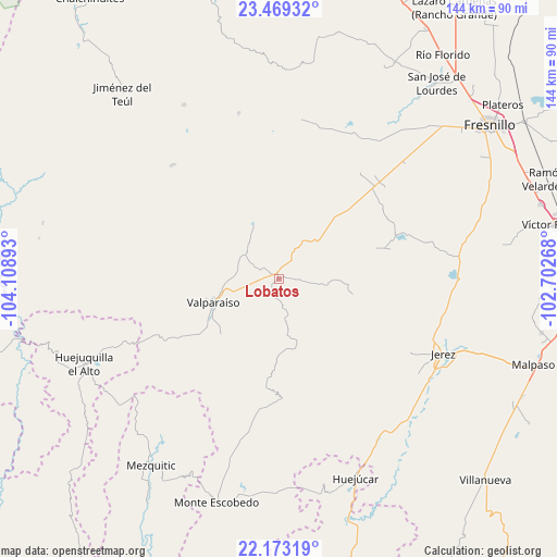
Lobatos GPS coordinates[2]
22° 49' 22.08" North, 103° 24' 20.88" West
| Map corner | latitude | longitude |
|---|---|---|
| Upper-left | 23.46932°, | -104.10893° |
| Center: | 22.8228°, | -103.4058° |
| Lower-right: | 22.17319°, | -102.70268° |
| Map W x H: | 144.1×144.1 km | = 89.5×89.5mi |
| max Lat: | 32.7° ⇑12.4% North |
| Lobatos: | 22.8228° |
| min Lat: | ⇓87.6% South 14.53588° |
| min Long | Lobatos | max Long |
| -117.105° | -103.4058° | -86.73105° |
| W 12.2%⇐ | ⇒87.8% E |
Elevation
Elevation of Lobatos is 2006 m = 6581 ft, and this is 752.3 m = 2468 ft above average elevation for this country.
| Max E: |
3497 m = 11473 ft | 26.2% |
| Lobatos | 2006 m 6581 ft | |
| Avg. | 1253.7 m = 4113 ft | |
Min E: |
-1 m = -3 ft | 73.8% |
See also: Mexico elevation on elevation.city.
Geographical zone
Lobatos is located in North Torrid zone (between Equator and Tropic of Cancer). Distance of this Northern Tropic circle is 68.3 km =42.4 mi to North.| Distance of | km | miles | from Lobatos |
|---|---|---|---|
| North Pole | 7469.4 | 4641.3 | to North |
| Arctic Circle | 4863.5 | 3022 | to North |
| Tropic Cancer | 68.3 | 42.4 | to North |
| Equator | 2537.7 | 1576.9 | to South |


Nearby cities:
15 places around Lobatos: (largest is in red/bold)
• Buenavista de Trujillo
42.9 km =26.7 mi,  31°
31°
• Ermita de los Correas
41 km =25.5 mi,  76°
76°
• Guadalupe Trujillo
34.7 km =21.6 mi,  37°
37°
• J. Jesús González Ortega (San Mateo)
10.8 km =6.7 mi,  311°
311°
• Labor de Santa Barbara
29.7 km =18.5 mi, 44°
• Laguna Grande
43.5 km =27 mi,  193°
193°
• Matías Ramos
37.5 km =23.3 mi, 37°
• Melchor Ocampo (San Jerónimo)
44 km =27.3 mi, 35°
• Milpillas de la Sierra
40.5 km =25.2 mi,  316°
316°
• San José del Río
44.4 km =27.6 mi,  18°
18°
• Santa Rosa
32.3 km =20.1 mi,  68°
68°
• Susticacán
39.6 km =24.6 mi,  126°
126°
• Trojes
13.3 km =8.3 mi,  270°
270°
• Trujillo
44.1 km =27.4 mi, 31°
• Valparaíso
17.8 km =11.1 mi,  251°
251°
Sources, notices
• [Note1] Compared only with cities in Mexico existing in our database
• [Src1] Map data: © OpenStreetMap contributors (CC-BY-SA)
• [Src2] Other city data from geonames.org with taken over terms of usage.
• [Src3] Geographical zone / Annual Mean Temperature by Robert A. Rohde @ Wikipedia
