Efigenia geodata
Efigenia (Zacatecas) is a populated place; located in Mexico in America/Mexico_City (GMT-6) time zone. With population of 567 people, there are 15067 cities with bigger population in this country. Compared to other cities in Mexico, 89.3% of cities are located further ↓South; 80.2% of cities are located further →East and 80% of cities have lower elevation than Efigenia. Note1


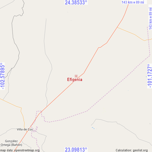
Efigenia GPS coordinates[2]
23° 44' 35.952" North, 101° 52' 32.952" West
| Map corner | latitude | longitude |
|---|---|---|
| Upper-left | 24.38533°, | -102.57895° |
| Center: | 23.74332°, | -101.87582° |
| Lower-right: | 23.09813°, | -101.1727° |
| Map W x H: | 143.1×143.1 km | = 88.9×88.9mi |
| max Lat: | 32.7° ⇑10.7% North |
| Efigenia: | 23.74332° |
| min Lat: | ⇓89.3% South 14.53588° |
| min Long | Efigenia | max Long |
| -117.105° | -101.87582° | -86.73105° |
| W 19.8%⇐ | ⇒80.2% E |
Elevation
Elevation of Efigenia is 2140 m = 7021 ft, and this is 886.3 m = 2908 ft above average elevation for this country.
| Max E: |
3497 m = 11473 ft | 20% |
| Efigenia | 2140 m 7021 ft | |
| Avg. | 1253.7 m = 4113 ft | |
Min E: |
-1 m = -3 ft | 80% |
See also: Mexico elevation on elevation.city.
Geographical zone
Efigenia is located in North temperate zone (between Tropic of Cancer and the Arctic Circle). Distance of this Northern Tropic circle is 34.1 km =21.2 mi to South.| Distance of | km | miles | from Efigenia |
|---|---|---|---|
| North Pole | 7367.1 | 4577.7 | to North |
| Arctic Circle | 4761.2 | 2958.5 | to North |
| Tropic Cancer | 34.1 | 21.2 | to South |
| Equator | 2640 | 1640.4 | to South |


Nearby cities:
15 places around Efigenia: (largest is in red/bold)
• Cañas
52.4 km =32.6 mi,  229°
229°
• Cervantes
41.5 km =25.8 mi,  199°
199°
• El Rucio
42.8 km =26.6 mi,  209°
209°
• Emiliano Zapata (San Antonio del Burro)
34.3 km =21.3 mi,  237°
237°
• Guadalupe de las Corrientes
64.2 km =39.9 mi,  265°
265°
• Illescas
62.3 km =38.7 mi, 206°
• La Colorada [Estación de Ferrocarril]
61.1 km =38 mi,  276°
276°
• La Prieta
49.7 km =30.9 mi, 212°
• Nueva Pastoría
17.8 km =11.1 mi,  191°
191°
• San Tiburcio
59.8 km =37.2 mi,  41°
41°
• Santa Matilde
46.1 km =28.6 mi,  174°
174°
• Santo Domingo
48.5 km =30.1 mi,  162°
162°
• Sarteneja
18.3 km =11.4 mi,  112°
112°
• Tierra y Libertad (San Blas)
61.4 km =38.2 mi, 238°
• Zancarron
54.1 km =33.6 mi,  220°
220°
Sources, notices
• [Note1] Compared only with cities in Mexico existing in our database
• [Src1] Map data: © OpenStreetMap contributors (CC-BY-SA)
• [Src2] Other city data from geonames.org with taken over terms of usage.
• [Src3] Geographical zone / Annual Mean Temperature by Robert A. Rohde @ Wikipedia
