Guadalupe de las Corrientes geodata
Guadalupe de las Corrientes (Zacatecas) is a populated place; located in Mexico in America/Mexico_City (GMT-6) time zone. With population of 714 people, there are 12202 cities with bigger population in this country. Compared to other cities in Mexico, 89.3% of cities are located further ↓South; 84.1% of cities are located further →East and 70% of cities have lower elevation than Guadalupe de las Corrientes. Note1
Current local time in Guadalupe de las Corrientes:
10:28 AM, MondayDifference from your time zone: hours


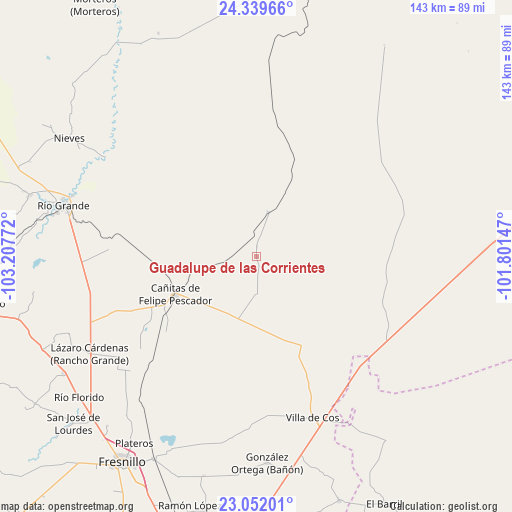
Guadalupe de las Corrientes GPS coordinates[2]
23° 41' 50.712" North, 102° 30' 16.524" West
| Map corner | latitude | longitude |
|---|---|---|
| Upper-left | 24.33966°, | -103.20772° |
| Center: | 23.69742°, | -102.50459° |
| Lower-right: | 23.05201°, | -101.80147° |
| Map W x H: | 143.2×143.2 km | = 89×89mi |
| max Lat: | 32.7° ⇑10.7% North |
| Guadalupe de las Corrientes: | 23.69742° |
| min Lat: | ⇓89.3% South 14.53588° |
| min Long | Guadalupe de la | max Long |
| -117.105° | -102.50459° | -86.73105° |
| W 15.9%⇐ | ⇒84.1% E |
Elevation
Elevation of Guadalupe de las Corrientes is 1924 m = 6312 ft, and this is 670.3 m = 2199 ft above average elevation for this country.
| Max E: |
3497 m = 11473 ft | 30% |
| Guadalupe de las Corrientes | 1924 m 6312 ft | |
| Avg. | 1253.7 m = 4113 ft | |
Min E: |
-1 m = -3 ft | 70% |
See also: Mexico elevation on elevation.city.
Geographical zone
Guadalupe de las Corrientes is located in North temperate zone (between Tropic of Cancer and the Arctic Circle). Distance of this Northern Tropic circle is 29 km =18 mi to South.| Distance of | km | miles | from Guadalupe de las Corrientes |
|---|---|---|---|
| North Pole | 7372.2 | 4580.9 | to North |
| Arctic Circle | 4766.3 | 2961.6 | to North |
| Tropic Cancer | 29 | 18 | to South |
| Equator | 2634.9 | 1637.3 | to South |


Nearby cities:
15 places around Guadalupe de las Corrientes: (largest is in red/bold)
• Boquilla de Abajo
39.9 km =24.8 mi,  246°
246°
• Boquilla de Arriba
42.2 km =26.2 mi, 249°
• Cañas
37.9 km =23.5 mi,  140°
140°
• Cañitas de Felipe Pescador
24.9 km =15.5 mi, 245°
• Emiliano Zapata (San Antonio del Burro)
37.4 km =23.2 mi,  110°
110°
• Estación Gutiérrez
40.1 km =24.9 mi,  226°
226°
• La Colorada [Estación de Ferrocarril]
12.9 km =8 mi,  14°
14°
• La Encantada
45.7 km =28.4 mi,  235°
235°
• La Quemada
37.6 km =23.4 mi, 236°
• Mezquitillo
10.3 km =6.4 mi,  178°
178°
• Milpillas de la Sierra
33 km =20.5 mi, 229°
• Rafael Yáñez Sosa (El Mezquite)
42.4 km =26.3 mi,  194°
194°
• San Pablo de Rancho Grande
44.7 km =27.8 mi, 248°
• Tetillas
41.2 km =25.6 mi,  272°
272°
• Tierra y Libertad (San Blas)
29.6 km =18.4 mi,  156°
156°
Sources, notices
• [Note1] Compared only with cities in Mexico existing in our database
• [Src1] Map data: © OpenStreetMap contributors (CC-BY-SA)
• [Src2] Other city data from geonames.org with taken over terms of usage.
• [Src3] Geographical zone / Annual Mean Temperature by Robert A. Rohde @ Wikipedia
