Tanque Nuevo geodata
Tanque Nuevo (San Luis Potosí) is a populated place; located in Mexico in America/Mexico_City (GMT-6) time zone. With population of 898 people, there are 9712 cities with bigger population in this country. Compared to other cities in Mexico, 90.7% of cities are located further ↓South; 73.2% of cities are located further →East and 70.4% of cities have lower elevation than Tanque Nuevo. Note1


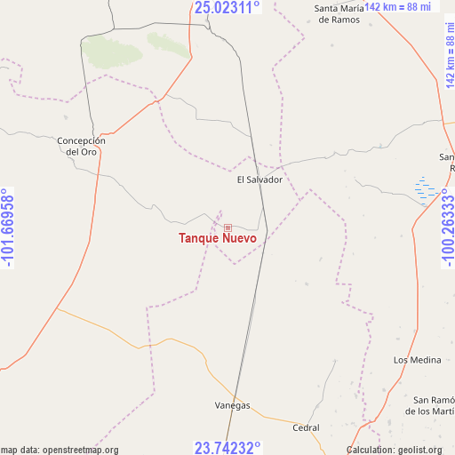
Tanque Nuevo GPS coordinates[2]
24° 23' 3.624" North, 100° 57' 59.22" West
| Map corner | latitude | longitude |
|---|---|---|
| Upper-left | 25.02311°, | -101.66958° |
| Center: | 24.38434°, | -100.96645° |
| Lower-right: | 23.74232°, | -100.26333° |
| Map W x H: | 142.4×142.4 km | = 88.5×88.5mi |
| max Lat: | 32.7° ⇑9.3% North |
| Tanque Nuevo: | 24.38434° |
| min Lat: | ⇓90.7% South 14.53588° |
| min Long | Tanque Nuevo | max Long |
| -117.105° | -100.96645° | -86.73105° |
| W 26.8%⇐ | ⇒73.2% E |
Elevation
Elevation of Tanque Nuevo is 1932 m = 6339 ft, and this is 678.3 m = 2225 ft above average elevation for this country.
| Max E: |
3497 m = 11473 ft | 29.6% |
| Tanque Nuevo | 1932 m 6339 ft | |
| Avg. | 1253.7 m = 4113 ft | |
Min E: |
-1 m = -3 ft | 70.4% |
See also: Mexico elevation on elevation.city.
Geographical zone
Tanque Nuevo is located in North temperate zone (between Tropic of Cancer and the Arctic Circle). Distance of this Northern Tropic circle is 105.4 km =65.5 mi to South.| Distance of | km | miles | from Tanque Nuevo |
|---|---|---|---|
| North Pole | 7295.8 | 4533.4 | to North |
| Arctic Circle | 4689.9 | 2914.2 | to North |
| Tropic Cancer | 105.4 | 65.5 | to South |
| Equator | 2711.3 | 1684.7 | to South |


Nearby cities:
15 places around Tanque Nuevo: (largest is in red/bold)
• Aquiles Serdán (La Hediondilla)
68.9 km =42.8 mi,  21°
21°
• Cedral
67.3 km =41.8 mi,  158°
158°
• Colonia Fovissste
48.3 km =30 mi,  301°
301°
• Concepción del Oro
52.3 km =32.5 mi, 299°
• El Salvador
18.3 km =11.4 mi,  33°
33°
• El Tepetate
23.6 km =14.7 mi,  188°
188°
• La Curva
49.9 km =31 mi, 301°
• La Yerba
70.7 km =43.9 mi,  136°
136°
• Las Delicias
65.7 km =40.8 mi, 29°
• Mazapil
65.9 km =40.9 mi, 295°
• San Isidro
60.8 km =37.8 mi, 161°
• San Tiburcio
58.9 km =36.6 mi,  243°
243°
• Terminal de Providencia
61 km =37.9 mi, 304°
• Vanegas
55.6 km =34.5 mi,  178°
178°
• Zaragoza (La Vaca)
39.3 km =24.4 mi, 193°
Sources, notices
• [Note1] Compared only with cities in Mexico existing in our database
• [Src1] Map data: © OpenStreetMap contributors (CC-BY-SA)
• [Src2] Other city data from geonames.org with taken over terms of usage.
• [Src3] Geographical zone / Annual Mean Temperature by Robert A. Rohde @ Wikipedia
