El Tepetate geodata
El Tepetate (San Luis Potosí) is a populated place; located in Mexico in America/Mexico_City (GMT-6) time zone. With population of 913 people, there are 9556 cities with bigger population in this country. Compared to other cities in Mexico, 90.4% of cities are located further ↓South; 73.4% of cities are located further →East and 62.5% of cities have lower elevation than El Tepetate. Note1


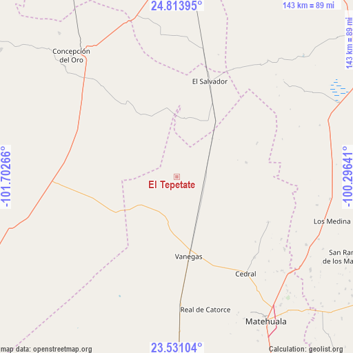
El Tepetate GPS coordinates[2]
24° 10' 26.796" North, 100° 59' 58.308" West
| Map corner | latitude | longitude |
|---|---|---|
| Upper-left | 24.81395°, | -101.70266° |
| Center: | 24.17411°, | -100.99953° |
| Lower-right: | 23.53104°, | -100.29641° |
| Map W x H: | 142.6×142.6 km | = 88.6×88.6mi |
| max Lat: | 32.7° ⇑9.6% North |
| El Tepetate: | 24.17411° |
| min Lat: | ⇓90.4% South 14.53588° |
| min Long | El Tepetate | max Long |
| -117.105° | -100.99953° | -86.73105° |
| W 26.6%⇐ | ⇒73.4% E |
Elevation
Elevation of El Tepetate is 1769 m = 5804 ft, and this is 515.3 m = 1691 ft above average elevation for this country.
| Max E: |
3497 m = 11473 ft | 37.5% |
| El Tepetate | 1769 m 5804 ft | |
| Avg. | 1253.7 m = 4113 ft | |
Min E: |
-1 m = -3 ft | 62.5% |
See also: Mexico elevation on elevation.city.
Geographical zone
El Tepetate is located in North temperate zone (between Tropic of Cancer and the Arctic Circle). Distance of this Northern Tropic circle is 82 km =51 mi to South.| Distance of | km | miles | from El Tepetate |
|---|---|---|---|
| North Pole | 7319.2 | 4547.9 | to North |
| Arctic Circle | 4713.3 | 2928.7 | to North |
| Tropic Cancer | 82 | 51 | to South |
| Equator | 2687.9 | 1670.2 | to South |


Nearby cities:
15 places around El Tepetate: (largest is in red/bold)
• Cedral
48.1 km =29.9 mi,  144°
144°
• Colonia Fovissste
61.6 km =38.3 mi,  322°
322°
• Concepción del Oro
64.7 km =40.2 mi, 319°
• El Salvador
40.9 km =25.4 mi,  19°
19°
• Estación Wadley
62.5 km =38.8 mi,  179°
179°
• La Curva
63.1 km =39.2 mi, 321°
• La Yerba
59.3 km =36.8 mi,  117°
117°
• Real de Catorce
55 km =34.2 mi,  167°
167°
• San Cayetano de Vacas
62.9 km =39.1 mi,  113°
113°
• San Isidro
41.2 km =25.6 mi,  146°
146°
• San Tiburcio
49.4 km =30.7 mi,  266°
266°
• Tanque Nuevo
23.6 km =14.7 mi,  8°
8°
• Vanegas
32.6 km =20.3 mi, 171°
• Villa de la Paz
62.6 km =38.9 mi, 152°
• Zaragoza (La Vaca)
15.9 km =9.9 mi,  201°
201°
Sources, notices
• [Note1] Compared only with cities in Mexico existing in our database
• [Src1] Map data: © OpenStreetMap contributors (CC-BY-SA)
• [Src2] Other city data from geonames.org with taken over terms of usage.
• [Src3] Geographical zone / Annual Mean Temperature by Robert A. Rohde @ Wikipedia
