Mazapil geodata
Mazapil (Zacatecas) is a seat of a second-order administrative division; located in Mexico in America/Mexico_City (GMT-6) time zone. With population of 794 people, there are 10982 cities with bigger population in this country. Compared to other cities in Mexico, 91.1% of cities are located further ↓South; 77.8% of cities are located further →East and 85.7% of cities have lower elevation than Mazapil. Note1


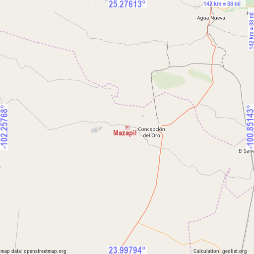
Mazapil GPS coordinates[2]
24° 38' 19.212" North, 101° 33' 16.38" West
| Map corner | latitude | longitude |
|---|---|---|
| Upper-left | 25.27613°, | -102.25768° |
| Center: | 24.63867°, | -101.55455° |
| Lower-right: | 23.99794°, | -100.85143° |
| Map W x H: | 142.1×142.1 km | = 88.3×88.3mi |
| max Lat: | 32.7° ⇑8.9% North |
| Mazapil: | 24.63867° |
| min Lat: | ⇓91.1% South 14.53588° |
| min Long | Mazapil | max Long |
| -117.105° | -101.55455° | -86.73105° |
| W 22.2%⇐ | ⇒77.8% E |
Elevation
Elevation of Mazapil is 2274 m = 7461 ft, and this is 1020.3 m = 3347 ft above average elevation for this country.
| Max E: |
3497 m = 11473 ft | 14.3% |
| Mazapil | 2274 m 7461 ft | |
| Avg. | 1253.7 m = 4113 ft | |
Min E: |
-1 m = -3 ft | 85.7% |
See also: Mexico elevation on elevation.city.
Geographical zone
Mazapil is located in North temperate zone (between Tropic of Cancer and the Arctic Circle). Distance of this Northern Tropic circle is 133.6 km =83 mi to South.| Distance of | km | miles | from Mazapil |
|---|---|---|---|
| North Pole | 7267.5 | 4515.8 | to North |
| Arctic Circle | 4661.6 | 2896.6 | to North |
| Tropic Cancer | 133.6 | 83 | to South |
| Equator | 2739.6 | 1702.3 | to South |


Nearby cities:
15 places around Mazapil: (largest is in red/bold)
• Agua Nueva
77.2 km =48 mi,  37°
37°
• Apizolaya
75.5 km =46.9 mi,  284°
284°
• Caopas
64.5 km =40.1 mi, 284°
• Cedros
22.6 km =14 mi, 281°
• Colonia Fovissste
18.5 km =11.5 mi,  99°
99°
• Concepción del Oro
14 km =8.7 mi, 101°
• Derramadero
77.4 km =48.1 mi,  20°
20°
• El Salvador
70.8 km =44 mi, 100°
• El Tepetate
76.3 km =47.4 mi,  132°
132°
• La Curva
17.1 km =10.6 mi, 97°
• Melchor Ocampo
23.2 km =14.4 mi,  337°
337°
• San Juan de la Vaquería
76.2 km =47.3 mi,  26°
26°
• San Tiburcio
55.2 km =34.3 mi,  172°
172°
• Tanque Nuevo
65.9 km =40.9 mi,  115°
115°
• Terminal de Providencia
10.8 km =6.7 mi,  56°
56°
Sources, notices
• [Note1] Compared only with cities in Mexico existing in our database
• [Src1] Map data: © OpenStreetMap contributors (CC-BY-SA)
• [Src2] Other city data from geonames.org with taken over terms of usage.
• [Src3] Geographical zone / Annual Mean Temperature by Robert A. Rohde @ Wikipedia
