Pastora geodata
Pastora (San Luis Potosí) is a populated place; located in Mexico in America/Mexico_City (GMT-6) time zone. With population of 1,007 people, there are 8660 cities with bigger population in this country. Compared to other cities in Mexico, 84.9% of cities are located further ↓South; 64.7% of cities are located further →East and 59.6% of cities have higher elevation than Pastora. Note1


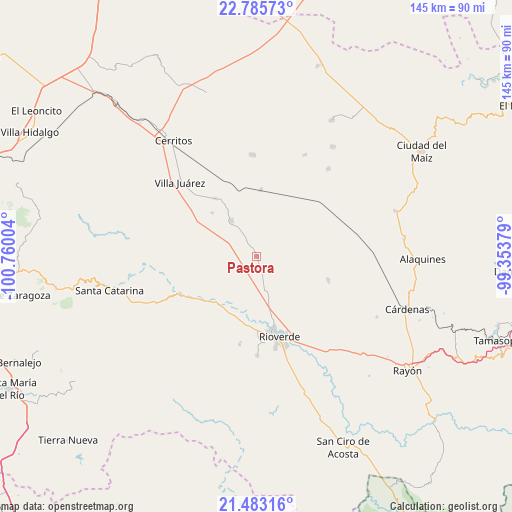
Pastora GPS coordinates[2]
22° 8' 9.42" North, 100° 3' 24.876" West
| Map corner | latitude | longitude |
|---|---|---|
| Upper-left | 22.78573°, | -100.76004° |
| Center: | 22.13595°, | -100.05691° |
| Lower-right: | 21.48316°, | -99.35379° |
| Map W x H: | 144.8×144.8 km | = 90×90mi |
| max Lat: | 32.7° ⇑15.1% North |
| Pastora: | 22.13595° |
| min Lat: | ⇓84.9% South 14.53588° |
| min Long | Pastora | max Long |
| -117.105° | -100.05691° | -86.73105° |
| W 35.3%⇐ | ⇒64.7% E |
Elevation
Elevation of Pastora is 1022 m = 3353 ft, and this is 231.7 m = 760 ft below average elevation for this country.
| Max E: |
3497 m = 11473 ft | 59.6% |
| Avg. | 1253.7 m = 4113 ft | |
| Pastora | 1022 m = 3353 ft | |
Min E: |
-1 m = -3 ft | 40.4% |
See also: Mexico elevation on elevation.city.
Geographical zone
Pastora is located in North Torrid zone (between Equator and Tropic of Cancer). Distance of this Northern Tropic circle is 144.6 km =89.9 mi to North.| Distance of | km | miles | from Pastora |
|---|---|---|---|
| North Pole | 7545.8 | 4688.7 | to North |
| Arctic Circle | 4939.9 | 3069.5 | to North |
| Tropic Cancer | 144.6 | 89.9 | to North |
| Equator | 2461.3 | 1529.4 | to South |


Nearby cities:
15 places around Pastora: (largest is in red/bold)
• Barrio de Guadalupe
17.7 km =11 mi,  176°
176°
• Cieneguilla
21.5 km =13.4 mi,  200°
200°
• Ciudad Fernández
22.2 km =13.8 mi,  167°
167°
• Colonia Veinte de Noviembre
17.4 km =10.8 mi, 177°
• La Noria
14.8 km =9.2 mi,  205°
205°
• La Reforma
15.7 km =9.8 mi,  194°
194°
• La Tapona
20 km =12.4 mi,  218°
218°
• Labor Vieja
16.3 km =10.1 mi, 212°
• Las Adjuntas
19.5 km =12.1 mi, 179°
• Ojo de Agua de Solano
16.9 km =10.5 mi, 187°
• Progreso
12.6 km =7.8 mi,  324°
324°
• Rioverde
23.7 km =14.7 mi,  164°
164°
• San Bartolo
18.7 km =11.6 mi,  4°
4°
• San Francisco
21.4 km =13.3 mi,  108°
108°
• Santo Domingo
20.1 km =12.5 mi, 324°
Sources, notices
• [Note1] Compared only with cities in Mexico existing in our database
• [Src1] Map data: © OpenStreetMap contributors (CC-BY-SA)
• [Src2] Other city data from geonames.org with taken over terms of usage.
• [Src3] Geographical zone / Annual Mean Temperature by Robert A. Rohde @ Wikipedia
