Palmar Primero geodata
Palmar Primero (San Luis Potosí) is a populated place; located in Mexico in America/Mexico_City (GMT-6) time zone. With population of 1,016 people, there are 8570 cities with bigger population in this country. Compared to other cities in Mexico, 86.1% of cities are located further ↓South; 74.2% of cities are located further →East and 65.8% of cities have lower elevation than Palmar Primero. Note1


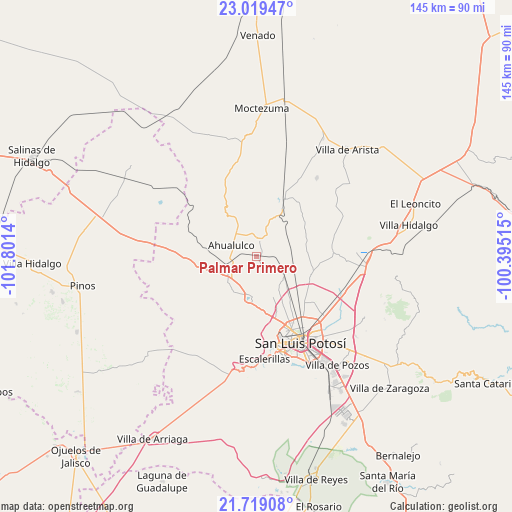
Palmar Primero GPS coordinates[2]
22° 22' 14.844" North, 101° 5' 53.772" West
| Map corner | latitude | longitude |
|---|---|---|
| Upper-left | 23.01947°, | -101.8014° |
| Center: | 22.37079°, | -101.09827° |
| Lower-right: | 21.71908°, | -100.39515° |
| Map W x H: | 144.6×144.6 km | = 89.9×89.9mi |
| max Lat: | 32.7° ⇑13.9% North |
| Palmar Primero: | 22.37079° |
| min Lat: | ⇓86.1% South 14.53588° |
| min Long | Palmar Primero | max Long |
| -117.105° | -101.09827° | -86.73105° |
| W 25.8%⇐ | ⇒74.2% E |
Elevation
Elevation of Palmar Primero is 1846 m = 6056 ft, and this is 592.3 m = 1943 ft above average elevation for this country.
| Max E: |
3497 m = 11473 ft | 34.2% |
| Palmar Primero | 1846 m 6056 ft | |
| Avg. | 1253.7 m = 4113 ft | |
Min E: |
-1 m = -3 ft | 65.8% |
See also: Mexico elevation on elevation.city.
Geographical zone
Palmar Primero is located in North Torrid zone (between Equator and Tropic of Cancer). Distance of this Northern Tropic circle is 118.5 km =73.6 mi to North.| Distance of | km | miles | from Palmar Primero |
|---|---|---|---|
| North Pole | 7519.7 | 4672.5 | to North |
| Arctic Circle | 4913.8 | 3053.3 | to North |
| Tropic Cancer | 118.5 | 73.6 | to North |
| Equator | 2487.4 | 1545.6 | to South |


Nearby cities:
15 places around Palmar Primero: (largest is in red/bold)
• Ahualulco del Sonido Trece
7.7 km =4.8 mi,  295°
295°
• Cerrito de Rojas
12.4 km =7.7 mi,  310°
310°
• Colonia Emiliano Zapata (El Chamizal)
3.6 km =2.2 mi,  345°
345°
• Derramaderos
9.5 km =5.9 mi,  204°
204°
• El Carrizal
7.9 km =4.9 mi,  245°
245°
• El Zapote (Cerrito Blanco)
10 km =6.2 mi, 350°
• Las Moras
11.8 km =7.3 mi,  171°
171°
• Matancillas
12.3 km =7.6 mi,  158°
158°
• Mexquitic de Carmona
11.7 km =7.3 mi,  187°
187°
• Puerto de Providencia
3.4 km =2.1 mi,  100°
100°
• Ranchería de Guadalupe
12.1 km =7.5 mi,  241°
241°
• Rincón de San José
11.8 km =7.3 mi,  214°
214°
• Rincón del Porvenir
9.6 km =6 mi, 236°
• San Juan (San Juan de Coyotillos)
7.5 km =4.7 mi,  279°
279°
• San Pedro Ojo Zarco
9.1 km =5.7 mi,  121°
121°
Sources, notices
• [Note1] Compared only with cities in Mexico existing in our database
• [Src1] Map data: © OpenStreetMap contributors (CC-BY-SA)
• [Src2] Other city data from geonames.org with taken over terms of usage.
• [Src3] Geographical zone / Annual Mean Temperature by Robert A. Rohde @ Wikipedia
