Puerto de Providencia geodata
Puerto de Providencia (San Luis Potosí) is a populated place; located in Mexico in America/Mexico_City (GMT-6) time zone. With population of 1,265 people, there are 6842 cities with bigger population in this country. Compared to other cities in Mexico, 86.1% of cities are located further ↓South; 74% of cities are located further →East and 66.9% of cities have lower elevation than Puerto de Providencia. Note1
Current local time in Puerto de Providencia:
08:28 AM, WednesdayDifference from your time zone: hours


Puerto de Providencia GPS coordinates[2]
22° 21' 55.008" North, 101° 3' 56.016" West
| Map corner | latitude | longitude |
|---|---|---|
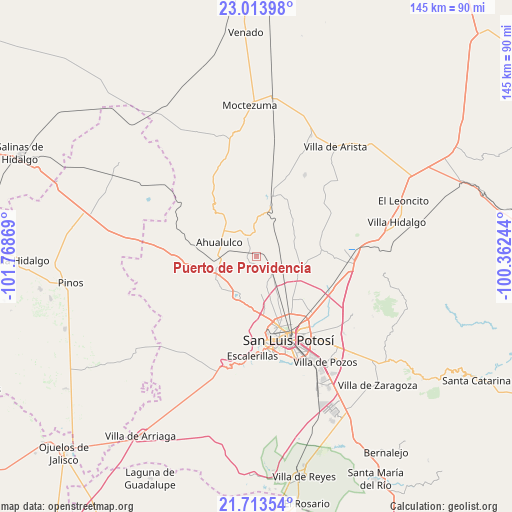
| Upper-left | 23.01398°, | -101.76869° |
| Center: | 22.36528°, | -101.06556° |
| Lower-right: | 21.71354°, | -100.36244° |
| Map W x H: | 144.6×144.6 km | = 89.9×89.9mi |
| max Lat: | 32.7° ⇑13.9% North |
| Puerto de Providencia: | 22.36528° |
| min Lat: | ⇓86.1% South 14.53588° |
| min Long | Puerto de Provi | max Long |
| -117.105° | -101.06556° | -86.73105° |
| W 26%⇐ | ⇒74% E |
Elevation
Elevation of Puerto de Providencia is 1867 m = 6125 ft, and this is 613.3 m = 2012 ft above average elevation for this country.
| Max E: |
3497 m = 11473 ft | 33.1% |
| Puerto de Providencia | 1867 m 6125 ft | |
| Avg. | 1253.7 m = 4113 ft | |
Min E: |
-1 m = -3 ft | 66.9% |
See also: Mexico elevation on elevation.city.
Geographical zone
Puerto de Providencia is located in North Torrid zone (between Equator and Tropic of Cancer). Distance of this Northern Tropic circle is 119.1 km =74 mi to North.| Distance of | km | miles | from Puerto de Providencia |
|---|---|---|---|
| North Pole | 7520.3 | 4672.9 | to North |
| Arctic Circle | 4914.4 | 3053.7 | to North |
| Tropic Cancer | 119.1 | 74 | to North |
| Equator | 2486.8 | 1545.2 | to South |


Nearby cities:
15 places around Puerto de Providencia: (largest is in red/bold)
• Ahualulco del Sonido Trece
11 km =6.8 mi,  290°
290°
• Colonia Emiliano Zapata (El Chamizal)
5.9 km =3.7 mi,  313°
313°
• Derramaderos
10.9 km =6.8 mi,  222°
222°
• Ejido de Moras
10.1 km =6.3 mi,  135°
135°
• El Carrizal
10.8 km =6.7 mi,  255°
255°
• El Peñasco
12.7 km =7.9 mi,  110°
110°
• El Zapote (Cerrito Blanco)
11.6 km =7.2 mi,  334°
334°
• Estanzuela
12.2 km =7.6 mi,  151°
151°
• Las Moras
11.2 km =7 mi,  187°
187°
• Matancillas
10.9 km =6.8 mi,  174°
174°
• Mexquitic de Carmona
12 km =7.5 mi,  203°
203°
• Palmar Primero
3.4 km =2.1 mi,  280°
280°
• Rincón del Porvenir
12.3 km =7.6 mi,  247°
247°
• San Juan (San Juan de Coyotillos)
10.9 km =6.8 mi, 279°
• San Pedro Ojo Zarco
6 km =3.7 mi,  133°
133°
Sources, notices
• [Note1] Compared only with cities in Mexico existing in our database
• [Src1] Map data: © OpenStreetMap contributors (CC-BY-SA)
• [Src2] Other city data from geonames.org with taken over terms of usage.
• [Src3] Geographical zone / Annual Mean Temperature by Robert A. Rohde @ Wikipedia
